A complete guide to camping in Idaho

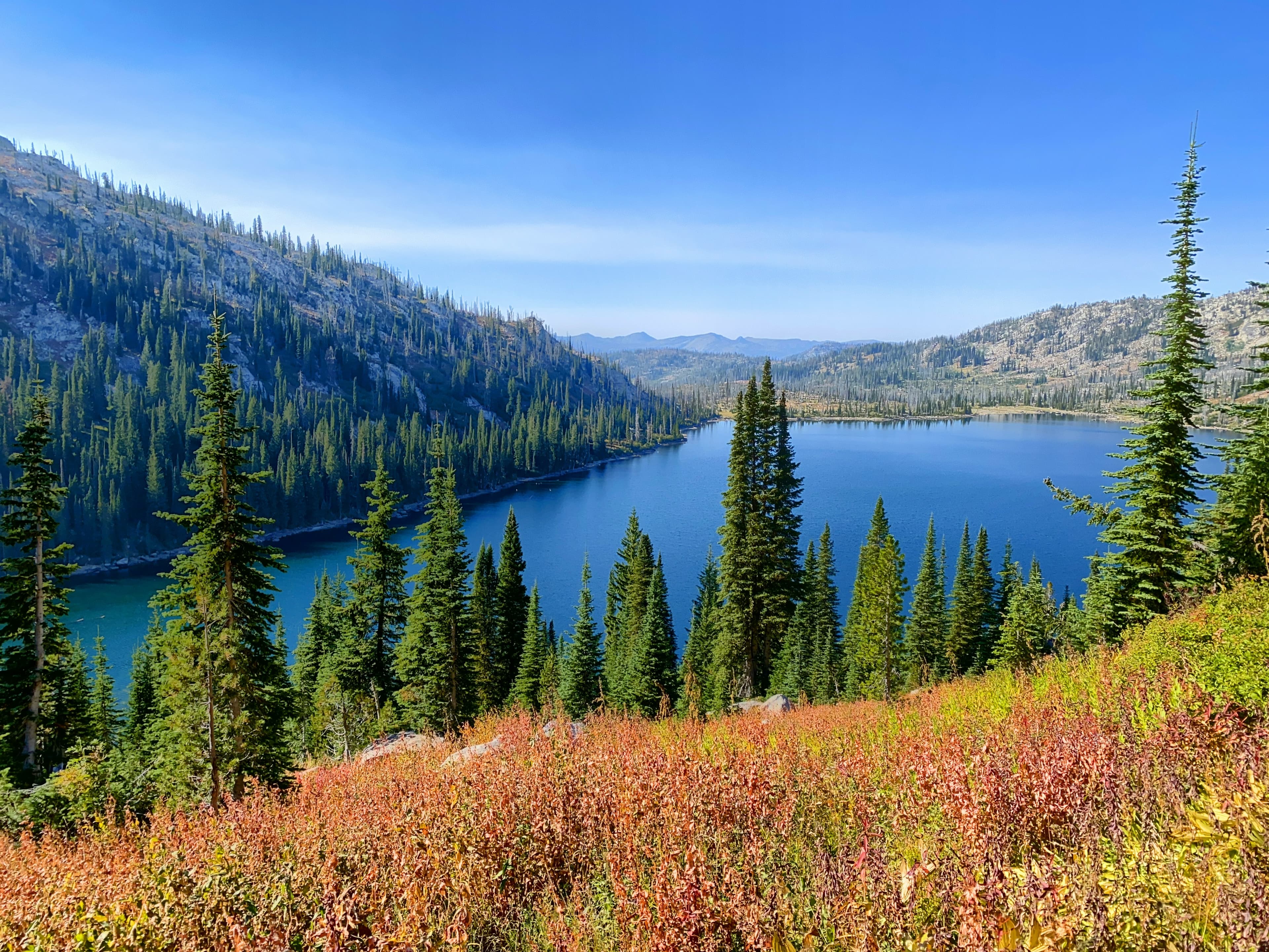
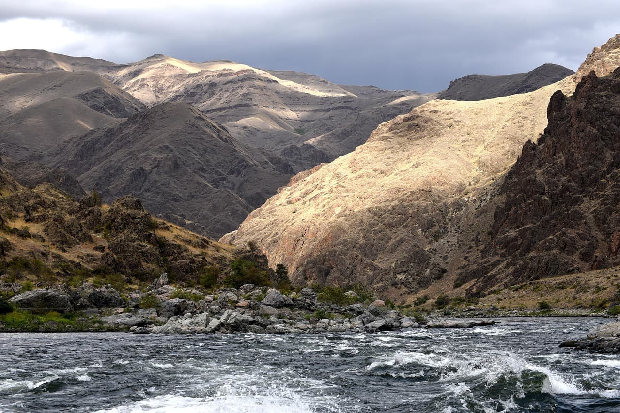
Idaho camping operates in the spaces between mountain ranges. The state's terrain is dominated by the Sawtooth, Bitterroot, and Salmon River mountains, with narrow valleys and river corridors providing the access points. Stanley sits at 6,200 feet in the Sawtooth Valley, one of the most scenic campground settings in the American West. The Salmon River, the longest free-flowing river in the lower 48, carves through the Frank Church-River of No Return Wilderness, the largest contiguous wilderness area outside Alaska.
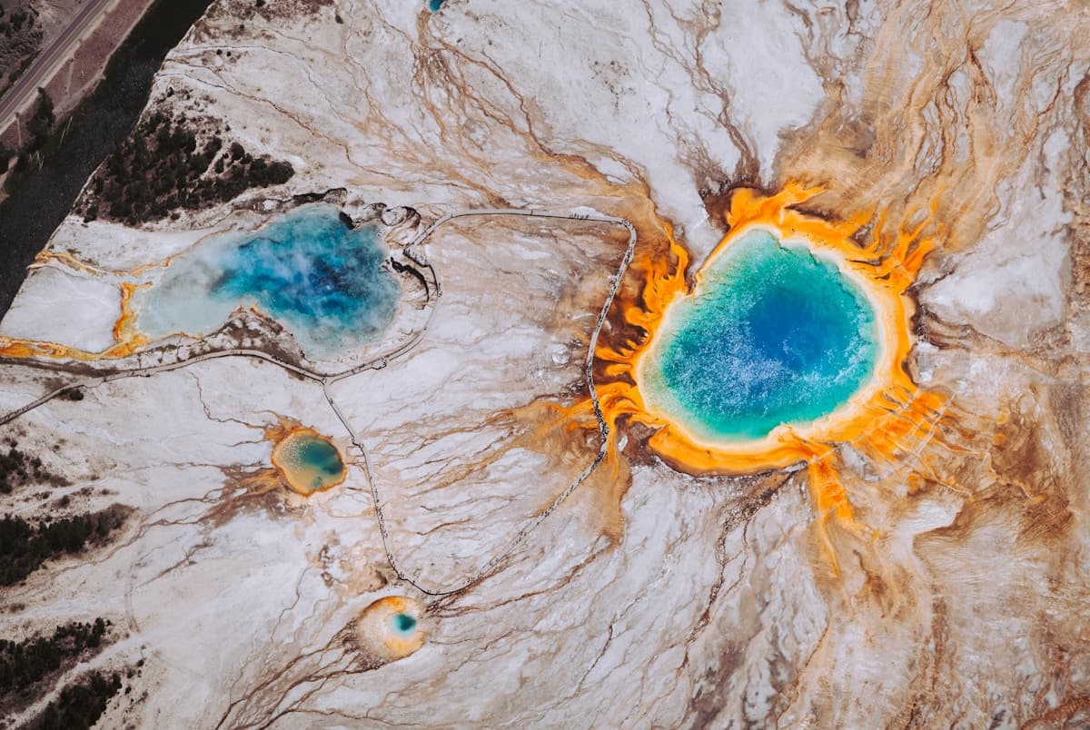
The southern half of the state drops into Snake River Plain lava fields and high desert around Mountain Home and the Boise foothills. Craters of the Moon National Monument offers camping on volcanic terrain unlike anything in the neighboring states. Northern Idaho around Cooskia and the Clearwater River connects to the Bitterroot Range and feels more like western Montana. The state's low population density means many campgrounds remain uncrowded even in peak season.
Mar-May
High 52°F · Low 40°F
Valley floors dry out by April. Mountain passes remain closed through May. The Boise foothills green up with wildflowers. River flows peak with snowmelt. Lower-elevation campgrounds open first.
Jun-Aug
High 71°F · Low 59°F
Mountain campgrounds open by late June as snow recedes. The Sawtooth Valley and Stanley area enter peak season. Hot springs along the Salmon River draw visitors. Southern Idaho desert temperatures climb into the 90s.
Sep-Nov
High 52°F · Low 40°F
September extends summer conditions at most elevations. Larch and aspen turn gold through early October. Mountain campgrounds begin closing by mid-October. Hunting season brings traffic to backcountry roads.
Dec-Feb
High 32°F · Low 20°F
Mountain campgrounds close under snow. January averages 24 degrees statewide. Lower elevations around Boise stay accessible. Sun Valley and McCall operate as winter recreation destinations. Hot springs camping remains popular year-round.
| Season | Months | Avg High | Avg Low | Conditions |
|---|---|---|---|---|
| Spring | Mar-May | 52°F | 40°F | Valley floors dry out by April. |
| Summer | Jun-Aug | 71°F | 59°F | Mountain campgrounds open by late June as snow recedes. |
| Fall | Sep-Nov | 52°F | 40°F | September extends summer conditions at most elevations. |
| Winter | Dec-Feb | 32°F | 20°F | Mountain campgrounds close under snow. |
Source: NOAA 30-Year Climate Normals

| Region | Terrain | Key Areas |
|---|---|---|
| Sawtooth Valley and Stanley | Mountain | Stanley, Ketchum, Sun Valley, Challis |
| Salmon River Country | Mountain | Salmon, Elk City, North Fork, Challis |
| Northern Idaho and Clearwater | Forest | Kooskia, Grangeville, Moscow, Orofino |
| Boise and Southwest | Plains | Cascade, McCall, Boise, Mountain Home |
| Snake River Plain and Craters | Desert | Arco, Twin Falls, Mountain Home, Shoshone |
Mountain · Stanley, Ketchum, Sun Valley, Challis
The most dramatic camping scenery in Idaho. The Sawtooth Range rises above Stanley at 6,200 feet. Redfish Lake, Alturas Lake, and the headwaters of the Salmon River provide mountain-lake camping. Developed Forest Service campgrounds line Highway 75 through the valley. Cold nights year-round. Stanley RV and Sockeye Campground in Stanley provide the primary developed options in the valley, while Meadows RV Park near Ketchum serves the Sun Valley corridor.
Mountain · Salmon, Elk City, North Fork, Challis
The Salmon River and its Middle Fork cut through deep canyons in central Idaho. Rafting, fishing, and hot springs anchor the recreation. The Frank Church Wilderness extends on both sides. Challis, Salmon, and Elk City serve as supply towns on the edges of the wilderness. Elk Bend RV Park and Andreas On The River RV Park in Salmon serve the main river town, with Riders Rest in Elk City covering the more remote Middle Fork access.
Forest · Kooskia, Grangeville, Moscow, Orofino
Dense forest and steep river canyons along the Clearwater and Lochsa rivers. Kooskia and the Highway 12 corridor provide access. The Selway-Bitterroot Wilderness borders Montana. Lewis and Clark traveled this route. Feels more like western Montana than the rest of Idaho. Johnson Bar Campground near Kooskia and Bear Den RV Resort in Grangeville serve the Clearwater and Lochsa river corridors.
Plains · Cascade, McCall, Boise, Mountain Home
The Boise foothills and Snake River corridor offer the most accessible camping from the state's largest city. The Boise National Forest extends northeast into the mountains. Cascade and McCall provide mountain-lake camping within two hours of Boise. Summer temperatures in the valley reach the 90s. Waters Edge RV Resort and Clear Creek Station RV Park in Cascade provide mountain-lake camping, while Black Bear RV Park in McCall adds a Payette Lake option.
Desert · Arco, Twin Falls, Mountain Home, Shoshone
Volcanic lava fields, high desert, and sagebrush steppe across southern Idaho. Craters of the Moon National Monument provides camping on lava flows. The Snake River canyon near Twin Falls adds a dramatic landscape. Hotter and drier than the mountain regions. Mountain View RV Park near Arco serves Craters of the Moon visitors, while Nat Soo Pah Hot Springs and Campground near Twin Falls combines hot spring soaking with camping.

Very remote. The Frank Church-River of No Return Wilderness has no roads through its 2.3 million acres. Towns like Stanley and Salmon sit on the edges with limited services. Cell service is absent in most of the backcountry. Carry all supplies, file a trip plan, and be prepared for self-rescue.
Dozens of natural hot springs are accessible from campgrounds throughout central Idaho. Kirkham Hot Springs near Lowman, Sunbeam Hot Springs near Stanley, and Boat Box Hot Springs along the Middle Fork are among the most popular. Many more require short hikes. Water temperatures vary by season and spring.
Multi-day float trips on the Middle Fork Salmon and Main Salmon River require permits allocated by lottery. The lottery opens in December for the following summer season. Day trips do not require permits on most sections. The Selway River also has a permit system.
Most Forest Service campgrounds above 5,000 feet open between late May and late June, depending on snowpack. The Sawtooth Valley around Stanley typically opens in mid-June. Lower elevations near Boise and the Snake River open in April or May. Check with the specific ranger district for current status.
Extensive national forest land covers central and northern Idaho, making dispersed camping widely available. No permits required for most areas. The Sawtooth, Boise, Salmon-Challis, and Nez Perce-Clearwater national forests all permit it. Stay limits of 14 days apply. Fire restrictions vary by season.