A complete guide to camping in Tennessee
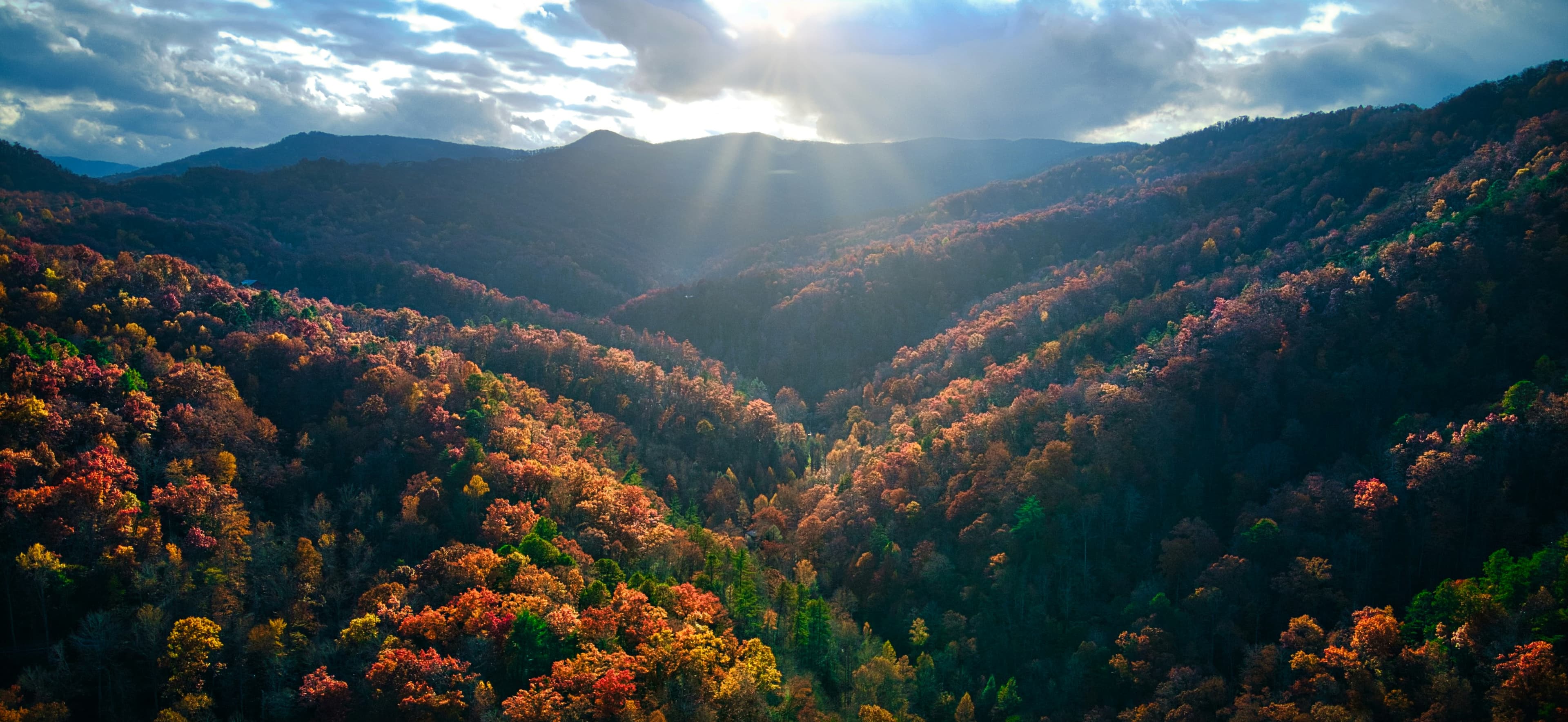
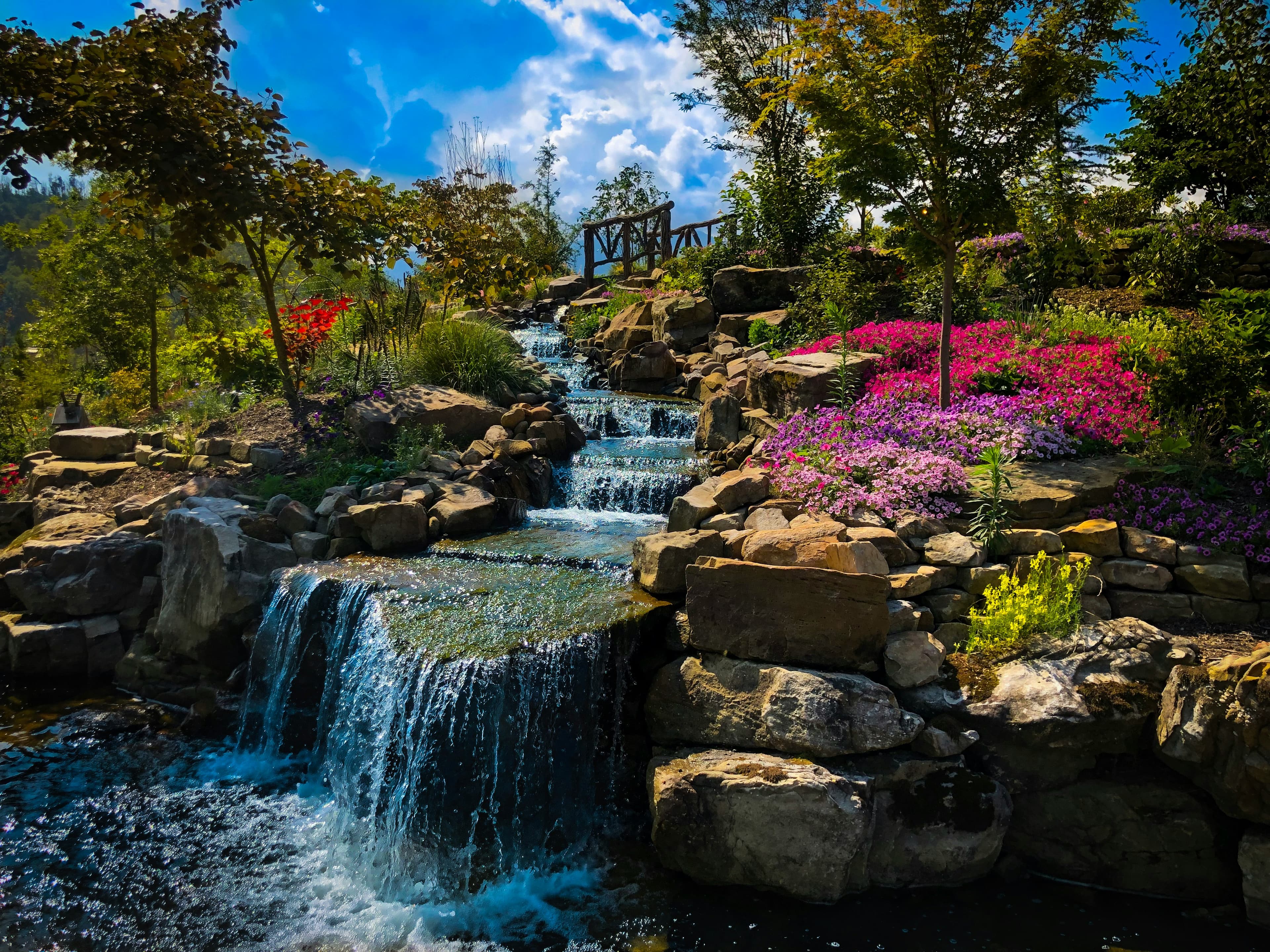
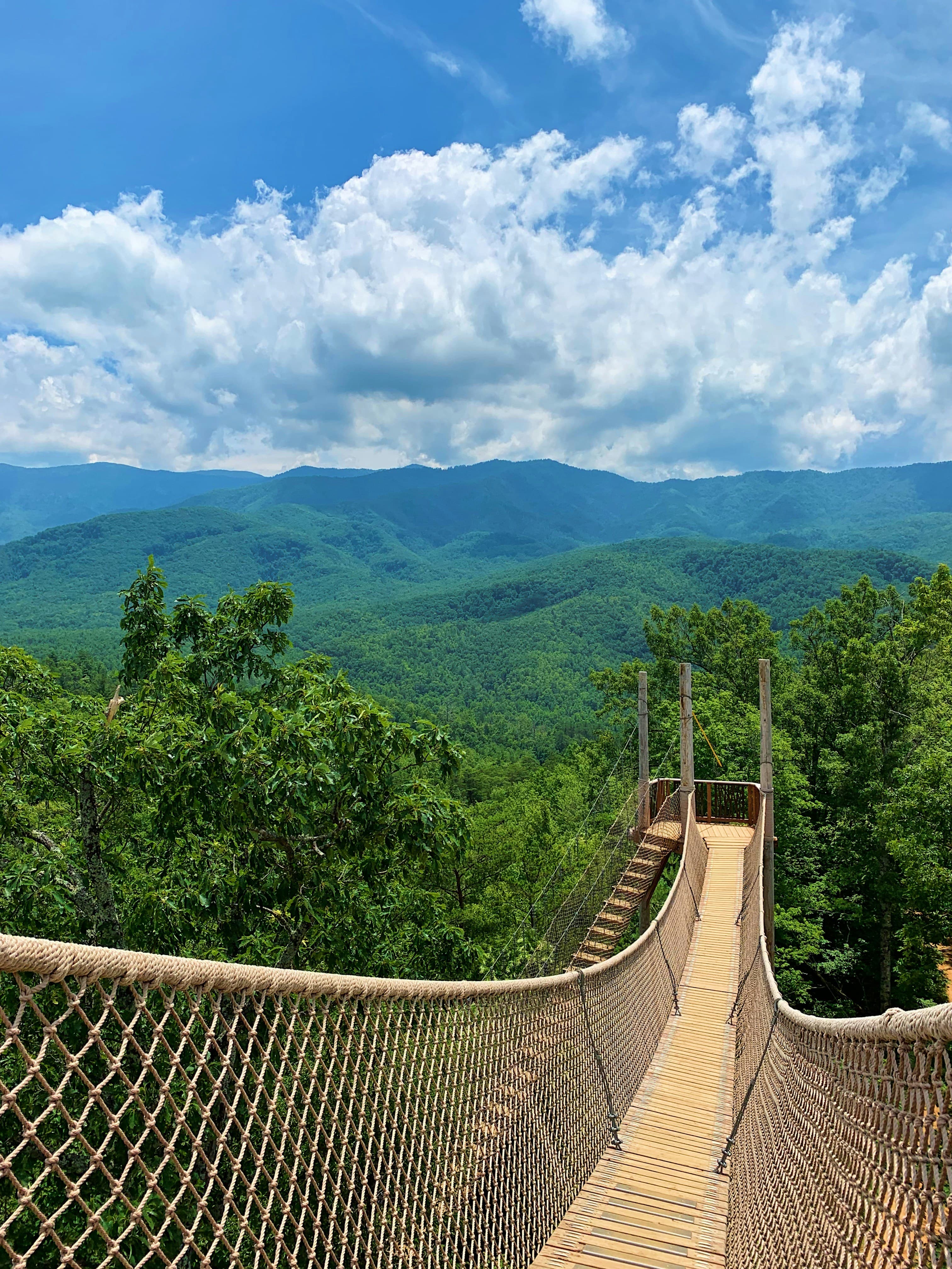
Tennessee's camping landscape splits between the mountainous eastern half and the flatter western plains, creating two distinct experiences within a single state. The Great Smoky Mountains anchor the eastern region, where towns like Gatlinburg, Pigeon Forge, and Sevierville cluster around the national park's western entrance. Campgrounds here sit at elevations from 1,000 to over 3,000 feet, surrounded by dense hardwood forest and cold mountain streams.
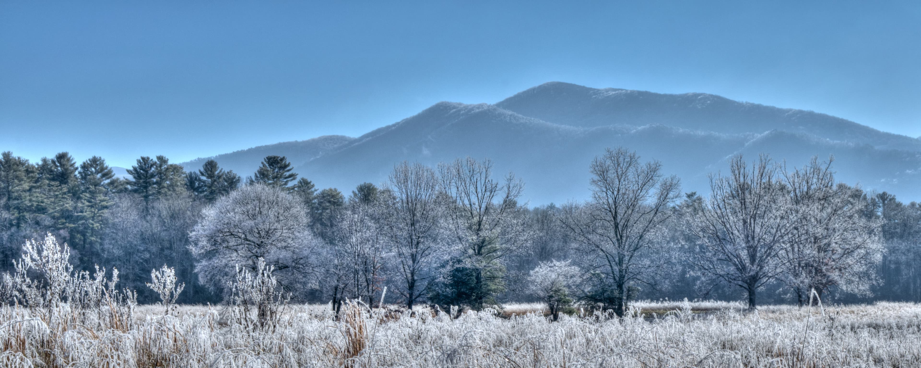
The central and western portions of the state drop into rolling hills and river valleys. The Tennessee River and its tributaries carve through the landscape, creating a network of lakes and waterways that support a different kind of camping. Clifton, Springville, and Tellico Plains serve as quieter bases for anglers and boaters. The terrain flattens toward Memphis, where the Mississippi River corridor offers yet another character. Tennessee's mild winters keep most campgrounds operational year-round, though the Smokies see their heaviest traffic between June and October.
Mar-May
High 61°F · Low 49°F
Wildflower blooms in the Smokies draw hikers as temperatures warm. Lower elevations reach the 70s while mountain areas remain cooler. Some higher trails may still have wet conditions in March.
Jun-Aug
High 79°F · Low 67°F
Peak camping season across the state. Mountain areas provide relief from the heat that builds in western Tennessee. Afternoon thunderstorms are common in the Smokies. Campgrounds near Gatlinburg and Pigeon Forge fill early.
Sep-Nov
High 61°F · Low 49°F
Fall color peaks in October across the Smokies, drawing large crowds to mountain campgrounds. Temperatures cool steadily and the humidity drops. Western Tennessee stays warm into November.
Dec-Feb
High 43°F · Low 31°F
Lower elevations remain campable with January averages around 36 degrees. Higher mountain campgrounds may close or operate with limited services. The Smokies see occasional snow above 3,000 feet.
| Season | Months | Avg High | Avg Low | Conditions |
|---|---|---|---|---|
| Spring | Mar-May | 61°F | 49°F | Wildflower blooms in the Smokies draw hikers as temperatures warm. |
| Summer | Jun-Aug | 79°F | 67°F | Peak camping season across the state. |
| Fall | Sep-Nov | 61°F | 49°F | Fall color peaks in October across the Smokies, drawing large crowds to mountain campgrounds. |
| Winter | Dec-Feb | 43°F | 31°F | Lower elevations remain campable with January averages around 36 degrees. |
Source: NOAA 30-Year Climate Normals

| Region | Terrain | Key Areas |
|---|---|---|
| Great Smoky Mountains Corridor | Mountain | Gatlinburg, Pigeon Forge, Sevierville, Cosby |
| Cherokee National Forest | Forest | Tellico Plains, Newport, Benton |
| Cumberland Plateau | Mountain | Crossville, Smithville, Manchester |
| Tennessee River Valley | Lakefront | Clifton, Springville, Paris |
| Nashville Basin and Western Tennessee | Plains | Nashville, Bristol, Memphis |
Mountain · Gatlinburg, Pigeon Forge, Sevierville, Cosby
The most concentrated camping region in the state. Gatlinburg, Pigeon Forge, Sevierville, and Cosby anchor a dense network of private campgrounds and national park sites. Elevation ranges from 1,000 to 3,000 feet. Mountain terrain with dense hardwood and conifer forests, cold streams, and waterfall hikes within short drives of camp. Greenbrier Campground and Camp LeConte near Gatlinburg, Camp Riverslanding in Pigeon Forge, and Elkmont Campground inside the national park provide the primary options across private and public land.
Forest · Tellico Plains, Newport, Benton
Stretching along Tennessee's eastern border, the Cherokee National Forest offers dispersed camping and developed Forest Service campgrounds. Tellico Plains and the Hiwassee River area draw anglers and paddlers. Higher elevations mean cooler summer temperatures and fewer crowds than the Smokies corridor. Cherohala Mountain Trails Campground near Tellico Plains and Tana-See Campground near Newport sit along the forest corridors.
Mountain · Crossville, Smithville, Manchester
The central plateau between the mountains and the Nashville basin features state parks with dramatic waterfalls and gorges. Fall Creek Falls and Savage Gulf offer developed campgrounds surrounded by sandstone bluffs and old-growth forest. Elevations sit around 1,500 to 2,000 feet. Deer Run RV Resort and Spring Lake RV Resort near Crossville provide developed bases for exploring the plateau parks.
Lakefront · Clifton, Springville, Paris
The western half of the state follows the Tennessee River and its reservoirs. Clifton, Springville, and the Kentucky Lake area cater to boaters and anglers. Flat to gently rolling terrain with milder winters. Campgrounds here offer a more laid-back pace and better availability during peak months. Hidden Oasis at White Oak Landing near Clifton and Myers Landing RV Resort near Springville serve the lake and river camping crowd.
Plains · Nashville, Bristol, Memphis
The Nashville area and points west offer proximity to urban services with a mix of private RV parks and state park campgrounds. Terrain flattens toward Memphis. Summer heat and humidity are more pronounced at lower elevations. Bristol anchors the northeast corner with access to both Tennessee and Virginia mountain camping. Two Rivers Campground and Nashville KOA Resort provide metro Nashville access, while Anderson Road Campground serves the J. Percy Priest Lake area.

June through October covers the prime window. Summer brings warm days and cool mountain nights, while October offers peak fall color. Spring wildflower season (April through May) is less crowded but wetter. Winter camping is possible at lower elevations, though some park campgrounds close November through March.
National park campgrounds in the Smokies require reservations and fill quickly for summer and fall dates. Many private campgrounds in the Gatlinburg and Pigeon Forge area also book out during peak season. Western Tennessee and Cumberland Plateau campgrounds generally have more walk-up availability.
Black bears are active throughout the Great Smoky Mountains region. The national park requires proper food storage and has bear boxes at developed campgrounds. Most private campgrounds in the Smokies corridor have bear awareness protocols. Bear encounters are less common in western Tennessee.
The Cherokee National Forest allows dispersed camping throughout most of its territory. No reservations required. Camp at least 100 feet from water sources and trails. The Cumberland Plateau has more limited dispersed options. National park backcountry camping requires a permit from the Great Smoky Mountains NP office.
Eastern mountain areas run 10 to 15 degrees cooler than the western plains in summer. Gatlinburg averages around 75 degrees in July while Memphis reaches 90. Winter brings occasional snow above 3,000 feet in the east, while western Tennessee rarely sees accumulation. Annual rainfall is higher in the mountains at 55 to 60 inches versus 50 in the west.