Camping Near Kings Canyon National Park
California | Established 1940
About Kings Canyon National Park
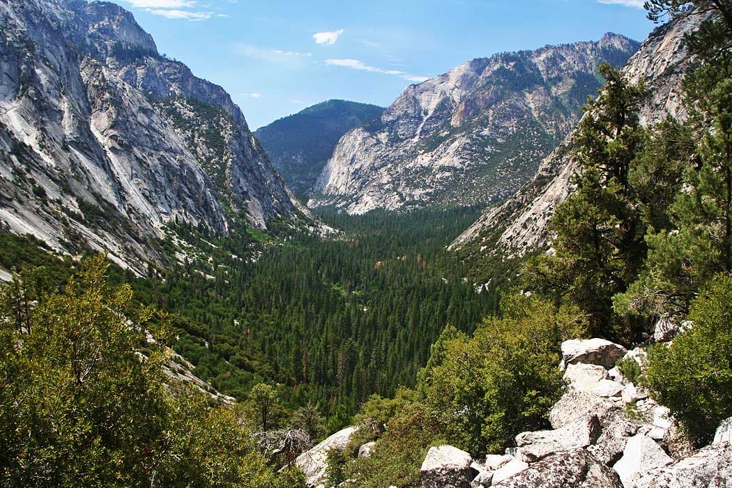
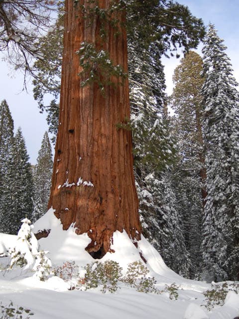
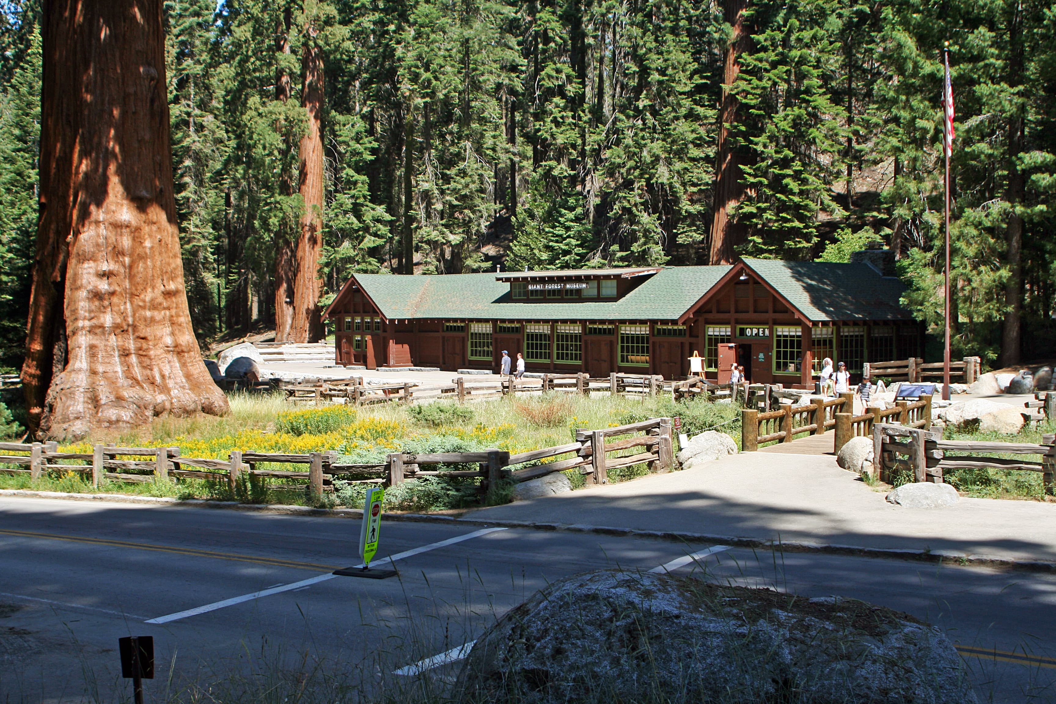
Kings Canyon National Park protects 461,901 acres of Sierra Nevada wilderness, from giant sequoia groves at Grant Grove to the dramatic granite gorge of Kings Canyon, which plunges over 8,000 feet from the surrounding peaks to the river floor. The park is jointly administered with neighboring Sequoia National Park, sharing a single entrance fee and interconnected road system. The General Grant Tree in Grant Grove stands 267 feet tall and holds the title of the Nation's Christmas Tree.
Cedar Grove, accessible via the 50-mile Kings Canyon Scenic Byway, offers four riverside campgrounds: Sentinel (82 sites), Sheep Creek (111 sites), Canyon View (23 sites), and Moraine (120 sites) at about $22 per night. Grant Grove's Azalea Campground (110 sites) stays open year-round among sequoias. Highway 180 to Cedar Grove closes mid-November through late April due to snow. Backcountry permits open access to the Rae Lakes Loop and John Muir Trail through some of the Sierra's most pristine high-country terrain.
Camping Tips for Kings Canyon
- Reserve Cedar Grove campgrounds (Sentinel, Sheep Creek, Moraine) on recreation.gov for summer. The 336 combined sites fill on July and August weekends. Canyon View operates first-come, first-served when open. Azalea at Grant Grove is open year-round.
- Highway 180 to Cedar Grove closes mid-November through late April. Plan Cedar Grove camping from May through October only. Check the park website for current road conditions since late snow can delay the opening.
- Bear-resistant food storage is required at all campgrounds and in the backcountry. Use the metal food storage boxes provided at developed sites. Rent bear canisters at the Roads End permit station for backcountry trips.
- Apply for backcountry permits on recreation.gov starting March 1 for peak season (late May through September). Popular routes like the Rae Lakes Loop have daily trailhead quotas. The permit fee is $15 per group plus $5 per person.
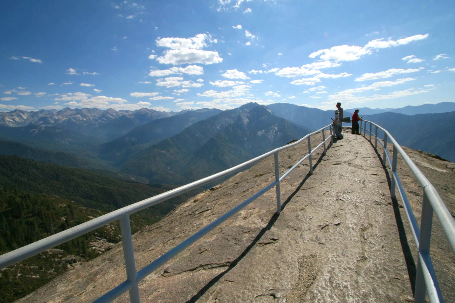
- Drive the Kings Canyon Scenic Byway slowly and stop at Grizzly Falls, Junction View, and Zumwalt Meadow. The 50-mile drive from Grant Grove to Roads End takes about 90 minutes with stops and descends 3,700 feet into the canyon.
RV Parks & Campgrounds Near Kings Canyon National Park

61.Mountain Glen Campground
Mountain Glen Campground is located in the Inyo National Forest. The campground offers various recreation opportunities, including biking, climbing, fishing, hiking, horse riding,...
Show more
62.Stony Creek Campground
Stony Creek Campground is located in the Sequoia National Forest. The campground offers various recreation opportunities such as biking, climbing and caving, fishing, hiking, and...
Show more
63.Hume Lake Campground
Hume Lake Campground is a scenic camping destination offering a variety of accommodation options for visitors seeking outdoor recreation. The campground provides access to Hume...
Show more
64.Rancheria Campground
The Sierra National Forest represents experiences through five wilderness areas, two nationally designated wild and scenic rivers, three nationally designated trails, and two...
Show more
65.Moraine Campground
Moraine Campground is located in Sequoia & Kings Canyon National Parks. The campground offers various types of campsites, including full hookups, partial hookups, and tent sites....
Show more
66.Upper Kings River PG&E group campsite
Upper Kings River PG&E group campsite is a group campground located in the Sierra National Forest. The campsite is open year-round and offers first-come, first-served campsites....
Show more
67.Diaz Lake
Diaz Lake is a 10-acre lake located in the Eastern Sierra region of California. The lake is a popular spot for fishing, boating, and birdwatching. The lake is surrounded by a...
Show more
68.Sage Flat Campground
Sage Flat Campground is located in the Inyo National Forest. The campground offers various recreation opportunities, including hiking, fishing, and horse riding. The area is known...
Show more69.Pleasant Valley Owens River Campground
Pleasant Valley Campground is located in Inyo County, California. Unfortunately, the provided website content does not contain a description of the park. However, it can be...
Show more
70.Island Park Campground
Island Park Recreation Area is a premier camping destination on Pine Flat Lake, a 20-mile-long reservoir with 67 miles of shoreline in the foothills of the central Sierra Nevada...
Show moreShowing 61–70 of 190 campgrounds within 50 miles
Frequently Asked Questions
What is the difference between Cedar Grove and Grant Grove?
Cedar Grove sits at 4,600 feet in the floor of Kings Canyon along the South Fork Kings River, offering four riverside campgrounds surrounded by towering granite walls. Grant Grove sits at 6,500 feet among giant sequoia groves, including the General Grant Tree. Cedar Grove closes seasonally; Grant Grove's Azalea Campground operates year-round.
Cedar Grove is the more dramatic setting with canyon walls rising thousands of feet above the river. It is more remote, requiring the 50-mile Scenic Byway drive from Grant Grove. Grant Grove is easier to access and closer to the park entrance, with sequoia walks and the Kings Canyon Visitor Center. Choose Cedar Grove for river activities, canyon hiking, and backcountry access. Choose Grant Grove for sequoia forest immersion, year-round availability, and proximity to Sequoia National Park.
When does Highway 180 to Cedar Grove open and close?
Highway 180 (Kings Canyon Scenic Byway) typically closes in mid-November and reopens in late April, depending on snow conditions. The road descends through steep alpine terrain that becomes impassable and unsafe in winter. Road conditions are updated on the park website throughout the spring opening process.
Late snow or rockslides can delay the opening into May. The road is well-maintained during the open season but has steep grades, tight curves, and limited shoulders through the canyon. The drive from Grant Grove to Cedar Grove takes about an hour without stops. No fuel is available between Grant Grove and Cedar Grove, so fill up before the drive. The road closure does not affect Grant Grove, which remains accessible year-round via Highway 180 from Fresno.
How do the Cedar Grove campgrounds compare?
Sentinel (82 sites, $22/night) is centrally located with flush toilets and river access. Sheep Creek (111 sites) is the largest and set slightly back from the river. Moraine (120 sites) offers the most spacious sites. Canyon View (23 sites) is smaller and operates first-come, first-served when open, not every season.
All Cedar Grove campgrounds are within walking distance of Cedar Grove Village, which has a small market, showers, laundry, and a snack bar. Sites accommodate tents and RVs but have no hookups. Maximum RV length varies from 30 to 40 feet depending on the specific site. Bear-proof food storage boxes are at every site. The Kings River runs alongside several campgrounds, offering fishing and wading. Reserve through recreation.gov for summer dates.
What is the Rae Lakes Loop backcountry trail?
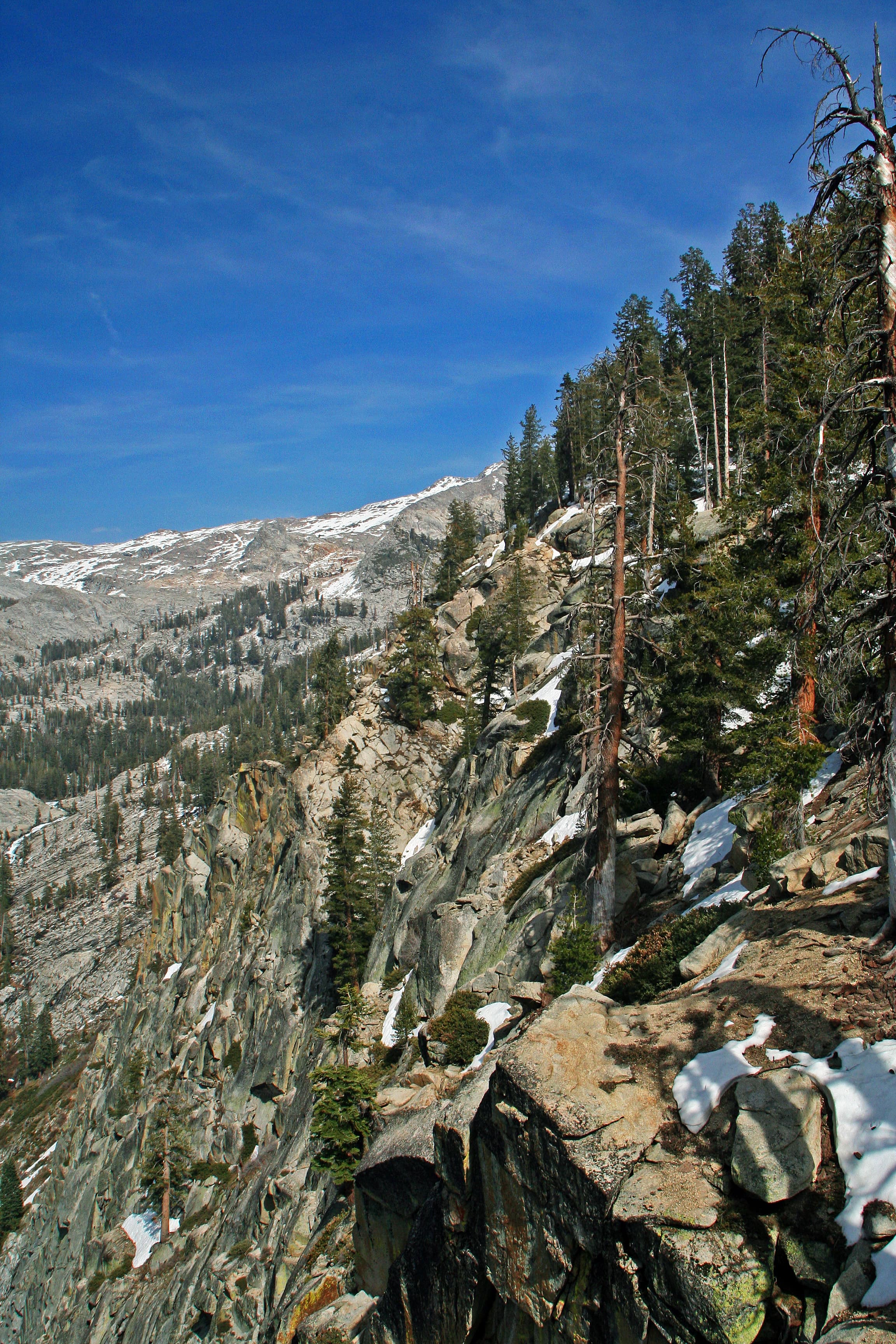
The Rae Lakes Loop is a 41-mile backcountry circuit starting from Roads End in Cedar Grove, passing through alpine lakes, granite passes, and meadows in the Sierra high country. Most backpackers complete it in four to five days. It shares a section with the John Muir Trail at Glen Pass (11,978 feet).
The loop requires a wilderness permit with daily trailhead quotas during peak season (late May through September). Apply on recreation.gov starting March 1. The permit fee is $15 per group plus $5 per person. Bear canisters are mandatory. The route crosses Glen Pass at nearly 12,000 feet, requiring acclimatization and fitness for high-altitude hiking. Snow can linger on passes into July. Permits for this popular route are competitive, so apply early and have backup dates ready.
What are the best easy hikes from Cedar Grove?
Zumwalt Meadow Trail (1.5 miles, flat) offers a riverside walk through a broad meadow with views of Grand Sentinel and North Dome. Roaring River Falls (0.3 miles) is a short paved walk to a powerful waterfall. Mist Falls (8 miles roundtrip, moderate) follows the Kings River to a 35-foot cascade.
Zumwalt Meadow is family-friendly and wheelchair accessible on the boardwalk section. The meadow is excellent for wildlife viewing at dawn, with mule deer and black bears frequently spotted. Roaring River Falls requires only a five-minute walk from the parking area. Mist Falls gains about 800 feet of elevation gradually along the river and is most impressive in May and June during peak snowmelt. All three hikes start from stops along the Scenic Byway near Cedar Grove Village.
What food storage rules apply in Kings Canyon?
All food, trash, toiletries, and scented items must be stored in bear-proof containers at all times when not in active use. Developed campgrounds provide metal food storage boxes at each site. Backcountry campers must carry approved bear canisters. Violations can result in citations and fines.
Black bears in Kings Canyon have learned to associate human food with campsites. A fed bear often becomes a dead bear, so strict food storage protects both visitors and wildlife. Never leave food in a tent, even briefly. The counter-balance hanging method is no longer accepted in most areas. Rent bear canisters at the Roads End permit station or Cedar Grove Visitor Center. Raccoons and ground squirrels also raid unattended food. Report any bear encounters or damage to rangers immediately.
Can I visit both Kings Canyon and Sequoia on one trip?
Yes. The two parks are adjacent and share a single $35 entrance fee valid for seven days. The Generals Highway connects Grant Grove in Kings Canyon to Giant Forest in Sequoia, making a combined visit natural. Most visitors spend at least two days to explore both parks, with campgrounds available in each.
The drive from Grant Grove to Giant Forest takes about one hour on the winding Generals Highway. Cedar Grove in Kings Canyon is in the opposite direction from Sequoia, so plan at least three days to see Grant Grove, Cedar Grove, and Giant Forest. Lodgepole Campground in Sequoia is a good counterpart to Azalea in Kings Canyon. The General Sherman Tree in Sequoia (the world's largest tree by volume) and the General Grant Tree in Kings Canyon make a compelling pair of visits.
What is the best time of year for fewer crowds?
September and early October offer warm days, cool nights, reduced crowds after Labor Day, and easier campsite availability. May and June bring pleasant spring conditions as campgrounds reopen, though some trails may still have snow at higher elevations. Summer (July through August) is peak season with the most visitors.
Fall camping at Cedar Grove provides warm daytime temperatures in the 70s with nighttime lows in the 40s and far fewer visitors than summer. Grant Grove's Azalea Campground stays open year-round for winter camping under snow-dusted sequoias. Spring wildflowers bloom in the canyon floor by late April. Cedar Grove roads typically reopen in late April, giving early visitors a window of light use before summer crowds arrive. Weekdays are consistently quieter than weekends in every season.
Quick Facts
- Entrance Fee
- $35/vehicle (7 days)
- Best Time to Visit
- May – October
- Nearest Town
- Three Rivers, CA, Visalia, CA, Fresno, CA
- Elevation
- 4,600 – 14,248 ft
- Park Size
- 461,901 acres
- Annual Visitors
- ~0.6 million