A complete guide to camping in Oregon
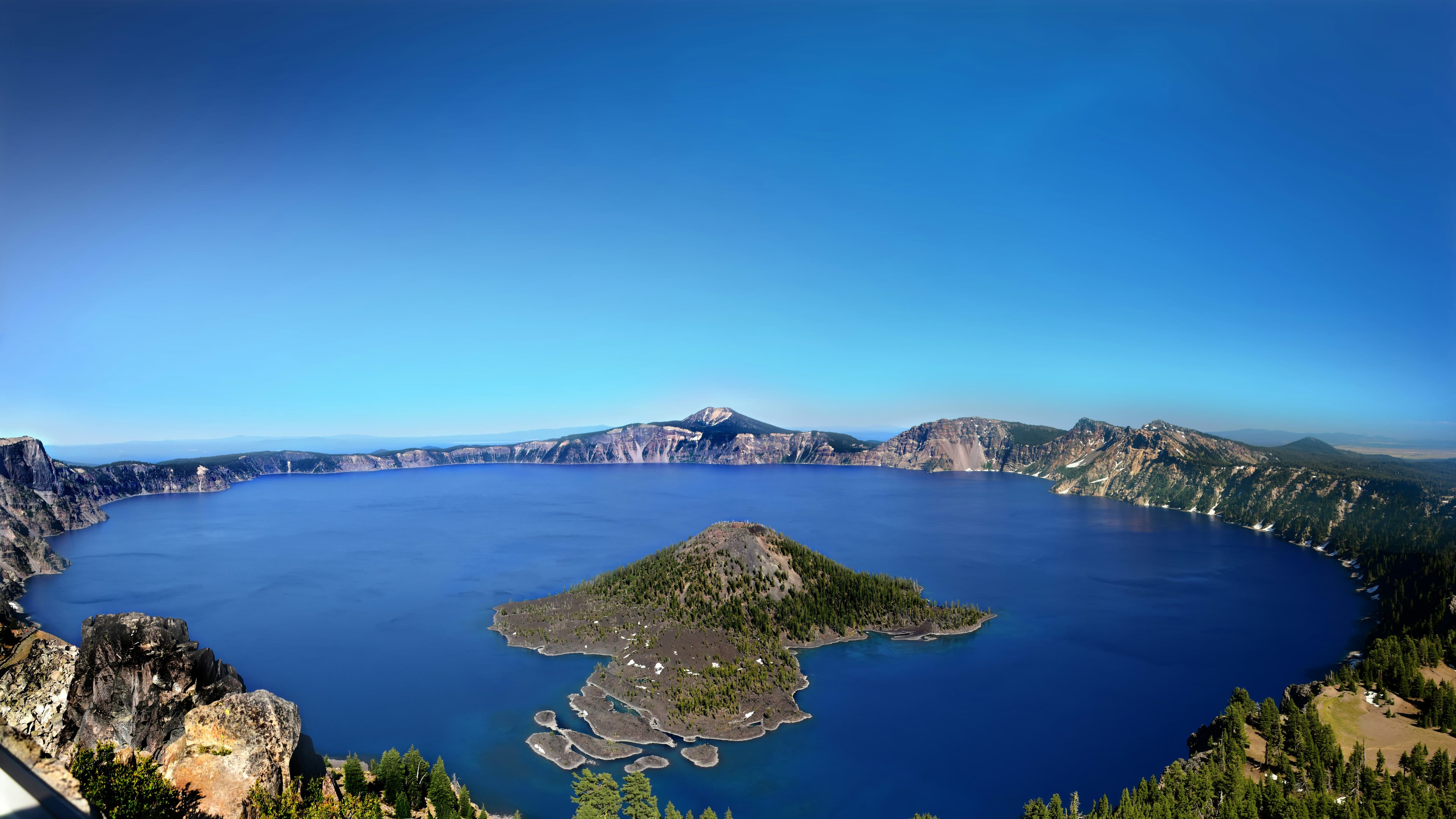
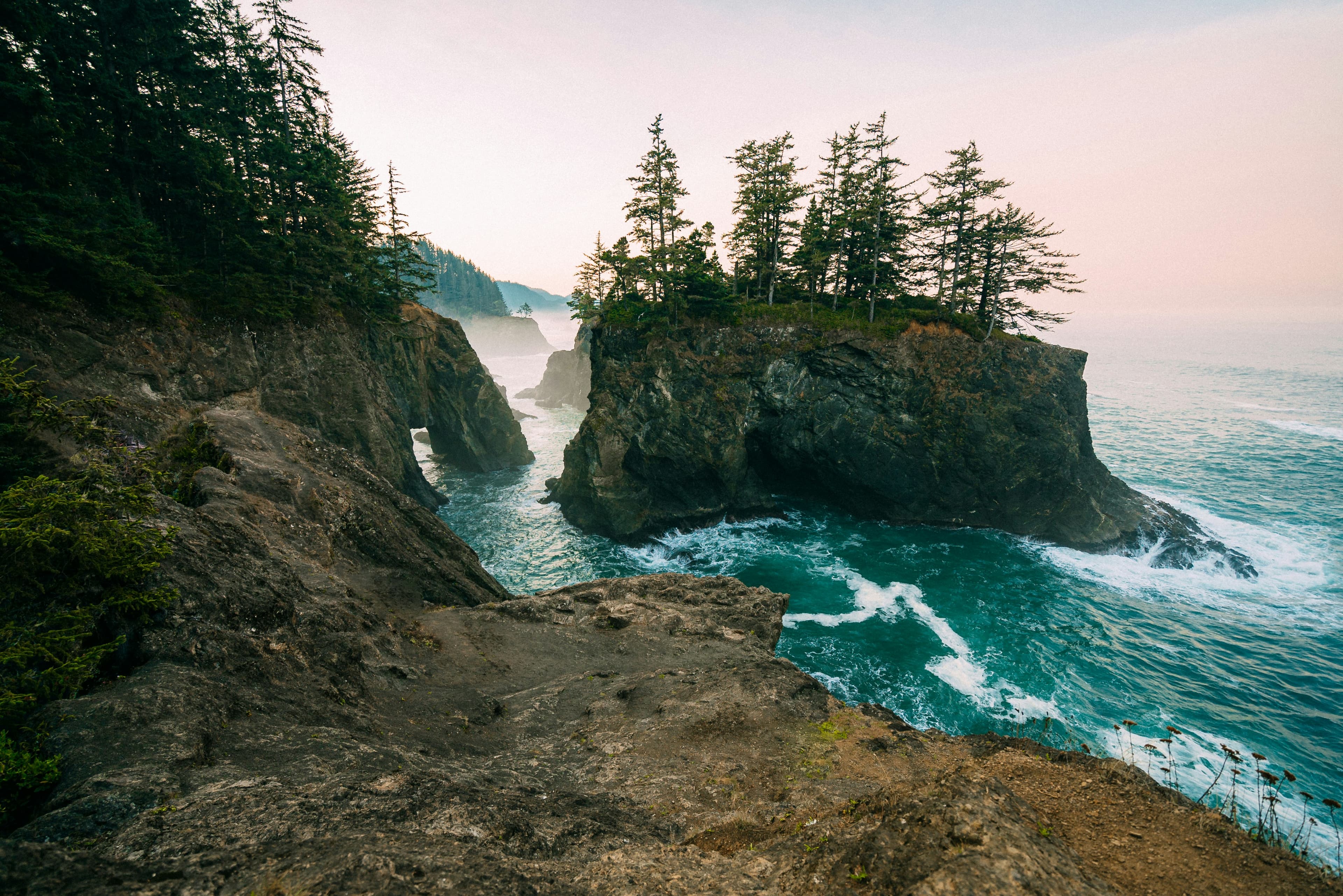
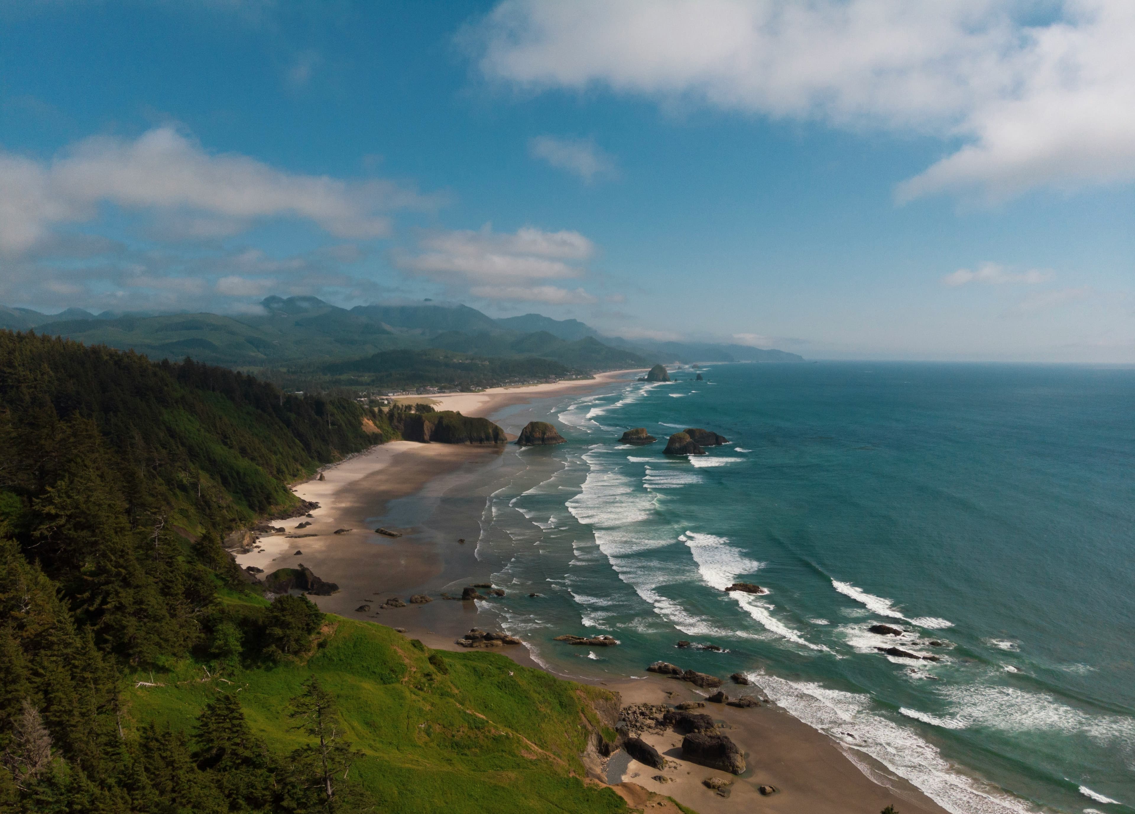
Oregon's camping runs along two axes: the Pacific coastline and the Cascade Range. The coast stretches 363 miles with public beach access guaranteed by state law, and campgrounds sit behind dunes, on coastal bluffs, and in old-growth Sitka spruce forests. The Cascades divide the state into a wet western side and a dry eastern plateau, each with its own camping character.
Central Oregon around Bend, Sisters, and Prineville has emerged as the state's camping hub. High desert terrain at 3,500 to 5,000 feet offers dry summers, clear skies, and access to both mountain lakes and the Deschutes River. The eastern half of the state opens into sagebrush steppe and river canyons, with the John Day region and Steens Mountain providing remote camping for those willing to drive. Western Oregon's Willamette Valley sits between the coast and Cascades, green and rainy, with access to both.
Mar-May
High 57°F · Low 45°F
Coast camping is viable year-round though wet. Cascade passes remain snow-covered through May. Central Oregon dries out by April. Wildflower season in the Columbia Gorge and eastern Oregon.
Jun-Aug
High 70°F · Low 58°F
Peak season statewide. Central Oregon and the Cascades fill on weekends. Coast campgrounds stay cooler with highs in the 60s. Eastern Oregon heats up. Forest fire smoke can impact air quality from late July.
Sep-Nov
High 57°F · Low 45°F
September is often the best camping month. Crowds thin, weather holds in Central Oregon, and fall color appears along the Cascades. Rain returns to the coast and western valleys by October. Many mountain campgrounds close by mid-October.
Dec-Feb
High 44°F · Low 32°F
Coast campgrounds stay open year-round with storm-watching as a draw. Cascade campgrounds close under snow. Central Oregon stays cold and dry. RV parks in the Willamette Valley serve as winter bases for travelers.
| Season | Months | Avg High | Avg Low | Conditions |
|---|---|---|---|---|
| Spring | Mar-May | 57°F | 45°F | Coast camping is viable year-round though wet. |
| Summer | Jun-Aug | 70°F | 58°F | Peak season statewide. |
| Fall | Sep-Nov | 57°F | 45°F | September is often the best camping month. |
| Winter | Dec-Feb | 44°F | 32°F | Coast campgrounds stay open year-round with storm-watching as a draw. |
Source: NOAA 30-Year Climate Normals

| Region | Terrain | Key Areas |
|---|---|---|
| Oregon Coast | Coastal | Florence, Cannon Beach, Newport, Brookings |
| Central Oregon High Desert | Plains | Bend, Sisters, Prineville, La Pine |
| Cascade Range | Mountain | Mount Hood, Detroit, McKenzie Bridge, Crater Lake |
| Southern Oregon | Forest | Grants Pass, Ashland, Cave Junction, Klamath Falls |
| Eastern Oregon | Desert | Maupin, John Day, Burns, Joseph |
Coastal · Florence, Cannon Beach, Newport, Brookings
State park campgrounds line the 363-mile coastline from Astoria to Brookings. Cool temperatures year-round with summer highs in the 60s. Fog, wind, and rain are constants from October through May. Cape Lookout, Fort Stevens, and Beverly Beach rank among the most popular. Storm-watching draws winter campers. Darlings Marina and RV Resort in Florence and RV Resort at Cannon Beach provide developed coastal options between the state parks.
Plains · Bend, Sisters, Prineville, La Pine
Bend, Sisters, Prineville, and La Pine anchor a dry, sunny camping region east of the Cascades. Elevation sits between 3,500 and 5,000 feet. The Deschutes River, Newberry Volcanic Monument, and Smith Rock draw outdoor recreationists. Summers are warm and dry. Winters bring cold and occasional snow. The Camp and Bend/Sisters Garden RV Resort serve the Bend area, while Sisters Creekside Campground adds a quieter option near the Cascade foothills.
Mountain · Mount Hood, Detroit, McKenzie Bridge, Crater Lake
The volcanic spine of Oregon running from Mount Hood south through the Three Sisters to Crater Lake. Alpine lakes, old-growth Douglas fir, and volcanic terrain define the camping. Season runs June through October depending on elevation. Crater Lake National Park campgrounds sit at 6,000 feet. Lakeview RV Park in Detroit and Cove Creek Campground provide developed access to the central Cascade lakes and trails.
Forest · Grants Pass, Ashland, Cave Junction, Klamath Falls
The Rogue River valley around Grants Pass and the Klamath Basin offer warmer temperatures than the northern half of the state. The Wild and Scenic Rogue River draws rafters and kayakers. Redwood groves extend into the far southwest corner. Ashland provides a cultural base with proximity to wilderness. Applegate River Golf and RV Resort and Bridgeview RV Resort in Grants Pass serve the Rogue River corridor.
Desert · Maupin, John Day, Burns, Joseph
High desert plateau, river canyons, and vast open spaces define the least-visited camping region. The John Day Fossil Beds, Steens Mountain, and the Owyhee Canyonlands attract solitude seekers. Maupin on the Deschutes River serves as the most accessible entry point. Extreme temperature swings between day and night. Maupin City Park and Deschutes RV Park in Maupin provide the most accessible camping along the Deschutes River float corridor.

July through September offers the driest and warmest conditions, with highs in the 60s. Summer fog is common mornings and evenings. Winter storm-watching (November through March) draws a dedicated crowd to coastal campgrounds. Rain is possible any month of the year.
Reservations open nine months in advance. Coastal campgrounds for summer weekends and holidays book within hours. Inland parks have more availability. Walk-up sites exist at some locations but are limited during peak season.
Mazama Campground near Crater Lake typically opens in June and closes in late September, weather permitting. The lake sits at 6,178 feet and snow can linger into July. The Rim Drive usually opens fully by mid-July. Reservations are recommended for summer visits.
National forest land throughout Oregon permits dispersed camping. The Deschutes, Ochoco, and Malheur national forests in Central and Eastern Oregon have the most accessible sites. BLM land in the high desert also allows camping. Follow 14-day stay limits and Leave No Trace principles.
Smoke from regional wildfires can impact air quality from late July through September, particularly in Central Oregon and the Cascades. Conditions vary dramatically year to year. Check AirNow.gov before your trip and have a backup plan. The coast tends to clear first due to ocean breezes.