A complete guide to camping in North Dakota
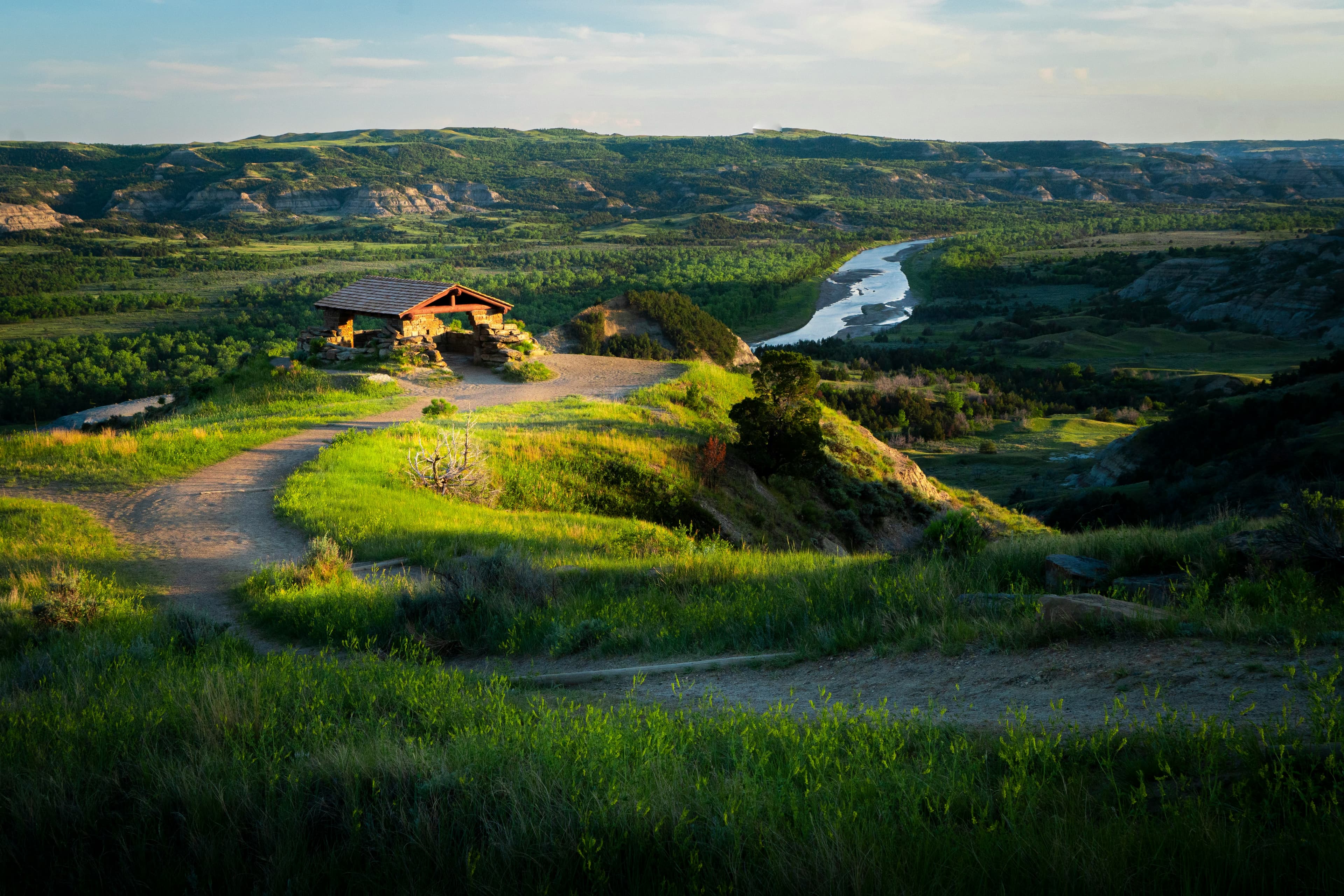
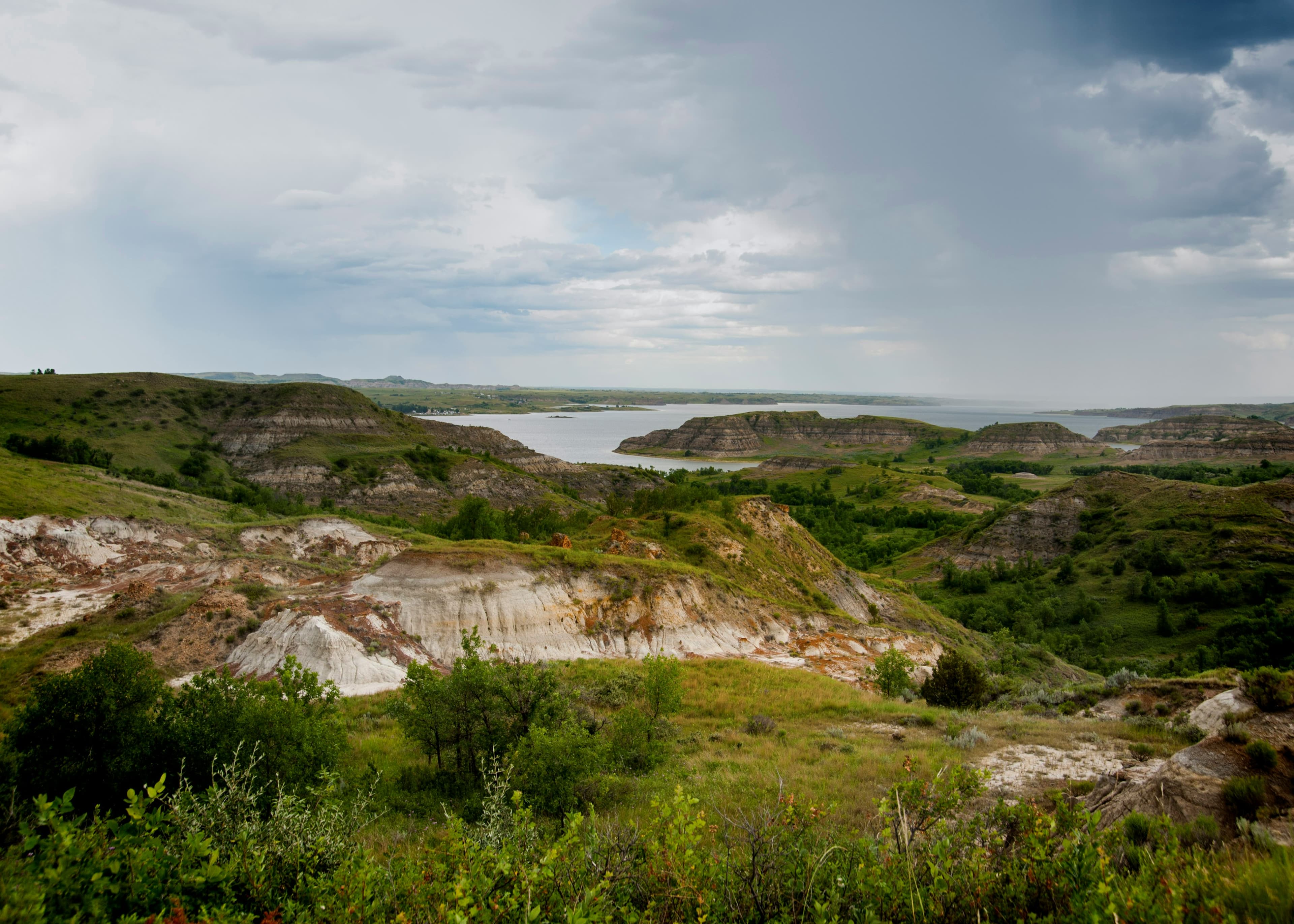
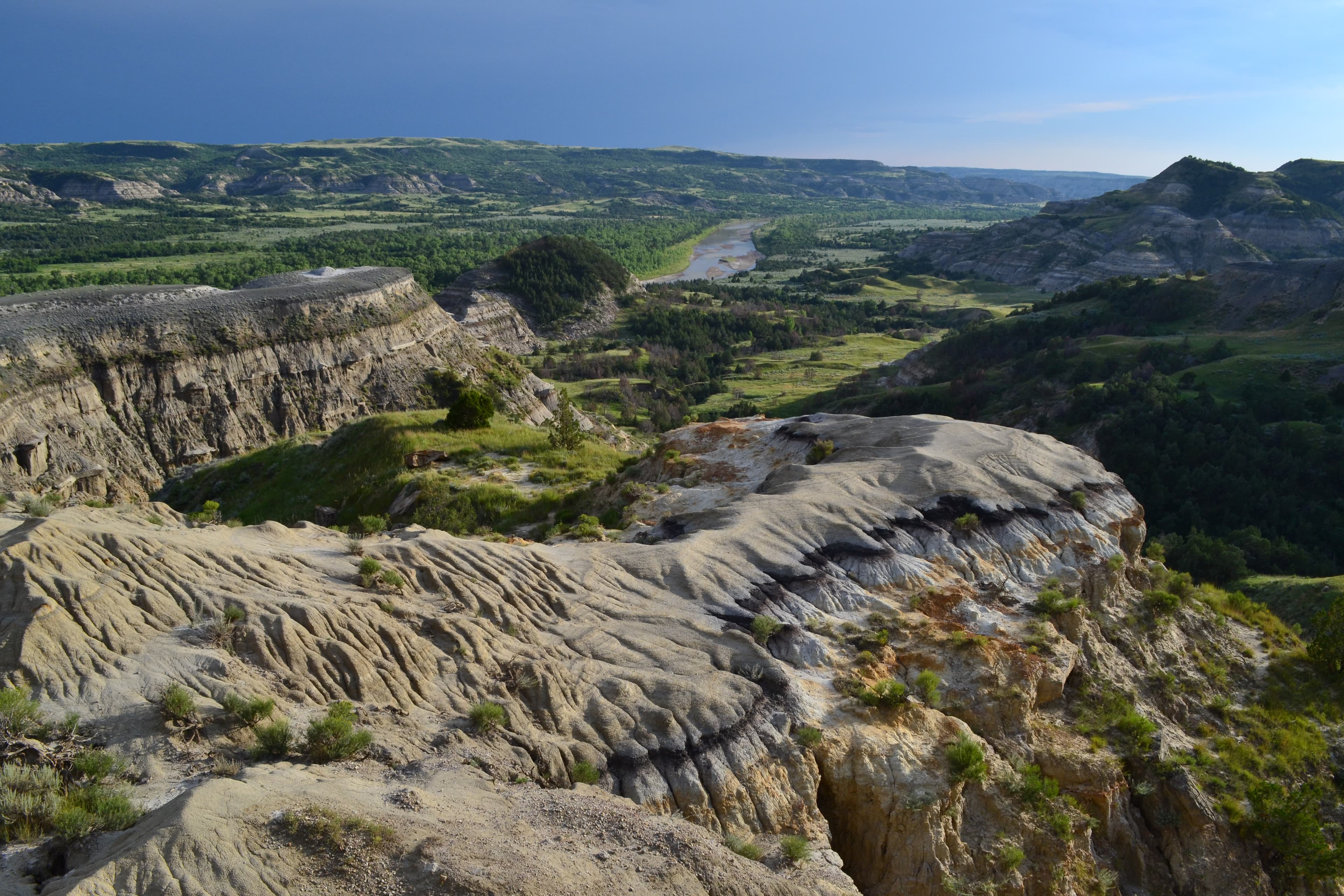
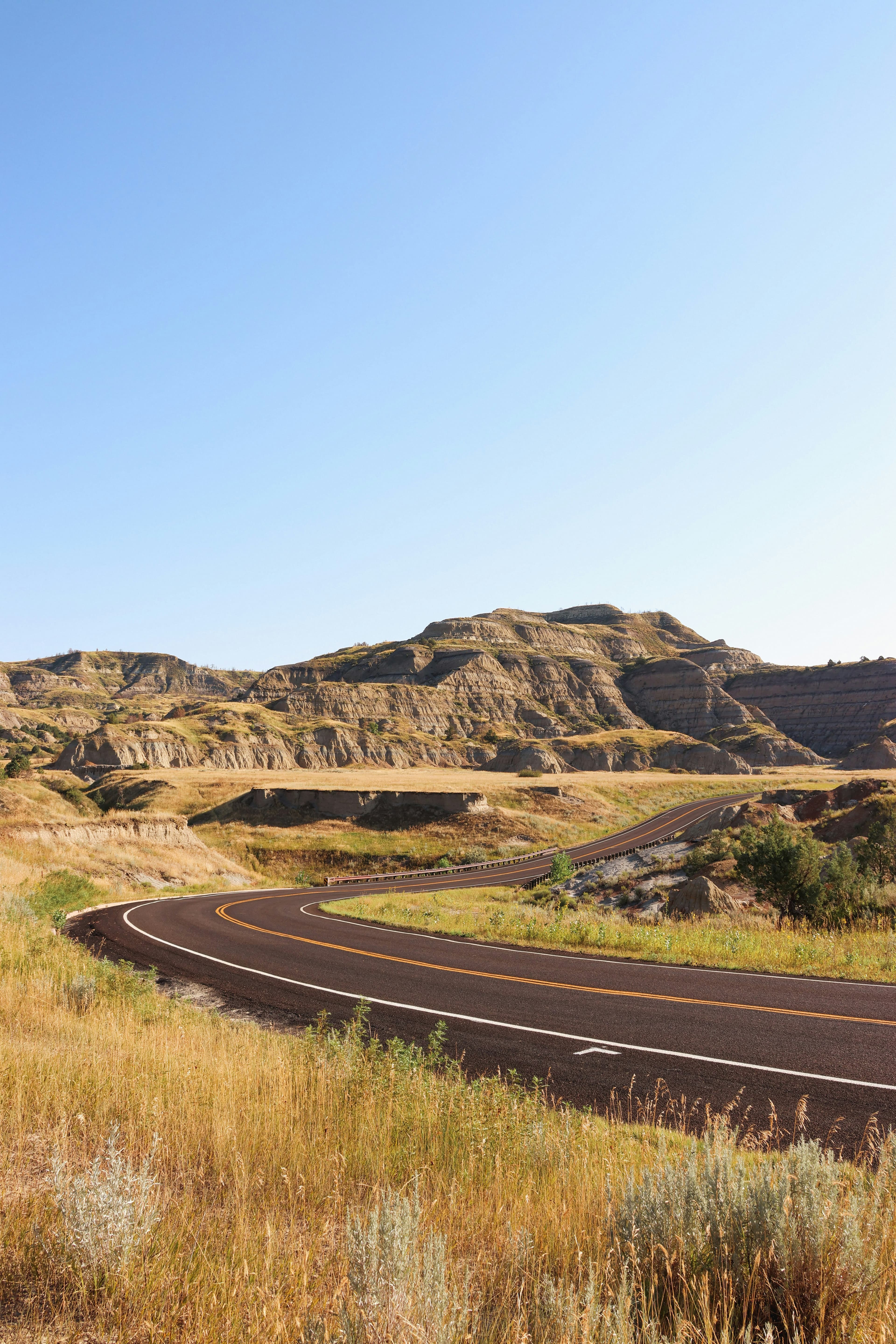
North Dakota camping builds around Theodore Roosevelt National Park in the western badlands, where painted canyon walls and bison herds create the most dramatic landscape between the Black Hills and Glacier. The park splits into a North Unit near Watford City and a South Unit near Medora, connected by the Little Missouri River. Medora, a tiny town preserved in Old West character, serves as the primary base for South Unit camping.
The rest of North Dakota's camping spreads across state parks, Corps of Engineers reservoirs, and the open prairie. Lake Sakakawea, one of the largest man-made lakes in the country, stretches across central North Dakota with camping along its irregular shoreline. Garrison and the dam area provide the most developed access. The Turtle Mountains near Bottineau in the north-central region and the Sheyenne National Grassland in the southeast add modest terrain variety. The state's extreme climate compresses camping into a May-through-September window, with July the only reliably warm month.
Mar-May
High 47°F · Low 35°F
Snow clears by April. Prairie greens up. Campgrounds begin opening in May. Migrating birds return. Temperatures reach the 50s and 60s. Wind is constant. The badlands landscape is dramatic after snowmelt.
Jun-Aug
High 73°F · Low 61°F
The camping season. Theodore Roosevelt National Park and Lake Sakakawea campgrounds operate at capacity in July. July averages 70 degrees but temperatures above 90 are common. Afternoon thunderstorms. Long daylight hours.
Sep-Nov
High 47°F · Low 35°F
September extends summer conditions. Cottonwoods along the Little Missouri turn gold. Bison and elk are more visible as vegetation thins. Campgrounds begin closing by mid-October. Cold arrives fast.
Dec-Feb
High 21°F · Low 9°F
January averages 12 degrees with wind chill far below zero. Campgrounds close. The badlands are accessible by vehicle year-round but camping is for extreme cold-weather specialists only.
| Season | Months | Avg High | Avg Low | Conditions |
|---|---|---|---|---|
| Spring | Mar-May | 47°F | 35°F | Snow clears by April. |
| Summer | Jun-Aug | 73°F | 61°F | The camping season. |
| Fall | Sep-Nov | 47°F | 35°F | September extends summer conditions. |
| Winter | Dec-Feb | 21°F | 9°F | January averages 12 degrees with wind chill far below zero. |
Source: NOAA 30-Year Climate Normals

| Region | Terrain | Key Areas |
|---|---|---|
| Theodore Roosevelt Badlands | Plains | Medora, Watford City, Beach, Killdeer |
| Lake Sakakawea | Lakefront | Garrison, Riverdale, Beulah, New Town |
| Turtle Mountains | Forest | Bottineau, Dunseith, Rugby |
| Missouri River and Eastern Prairie | Plains | Jamestown, Mandan, Valley City, Lisbon |
Plains · Medora, Watford City, Beach, Killdeer
The western badlands along the Little Missouri River. The South Unit near Medora and North Unit near Watford City bracket the most scenic terrain in North Dakota. Painted canyon walls, petrified forest, and free-roaming bison define the landscape. Medora's historic downtown adds Old West character. Red Trail Camp Grounds in Medora and Tobacco Gardens Resort and Marina near Watford City serve the South and North units of the park.
Lakefront · Garrison, Riverdale, Beulah, New Town
One of the largest reservoirs in the US, stretching 178 miles across central North Dakota behind Garrison Dam. State parks and Corps of Engineers campgrounds line the irregular shoreline. Fishing for walleye, northern pike, and smallmouth bass drives the camping. Garrison and Riverdale serve as access towns. Sakakawea RV and Stoney Hill RV Park in Garrison, and Morning Star Campground in Riverdale serve the dam and reservoir access area.
Forest · Bottineau, Dunseith, Rugby
A forested island of terrain in the north-central prairie near the Canadian border. Lake Metigoshe State Park and International Peace Garden provide camping among aspen and birch at the highest elevations in the northern half of the state. Bottineau serves as the base town. A different landscape from the prairie and badlands. Pelican Sandy Lake Recreation Area near Bottineau provides the primary public camping in the Turtle Mountain lake country.
Plains · Jamestown, Mandan, Valley City, Lisbon
The Missouri River corridor and the drift prairie east of it. Fort Abraham Lincoln State Park near Mandan combines camping with Custer-era history. Jamestown and Fort Ransom state parks provide eastern alternatives. The Sheyenne National Grassland in the southeast adds the state's only federal grassland camping. Jamestown Campground in Jamestown and Colonial RV Park in Mandan serve the Missouri River corridor and eastern access.

June through September. July and August bring the warmest temperatures. September offers cooler weather, fall color along the Little Missouri, and fewer crowds. Spring (May) is green but windy. The park roads stay open year-round but campgrounds close by late October.
Cottonwood Campground in the South Unit of Theodore Roosevelt National Park is first-come, first-served with no reservations. Arrive by early afternoon in summer. The North Unit's Juniper Campground is smaller and usually has availability. Both are modest in size and fill on peak summer weekends.
January averages 12 degrees statewide, but wind chill can drop below minus 30. The camping season realistically runs May through September. Shoulder months (May and September) can see freezing nights. Summer days occasionally reach the 90s. The temperature range across the year is over 130 degrees.
The Little Missouri National Grassland in the western badlands permits dispersed camping. The Sheyenne National Grassland in the southeast also allows it. No fee or permit required. State parks and Corps of Engineers campgrounds require designated sites. North Dakota has more federal grassland than most people expect.
Bison, wild horses, elk, mule deer, pronghorn, and prairie dogs are the most visible species. Bison roam through campgrounds. Wild horses in the South Unit are descendants of ranch stock. Golden eagles and ferruginous hawks patrol the badlands. Rattlesnakes inhabit rocky areas.