A complete guide to camping in New Mexico

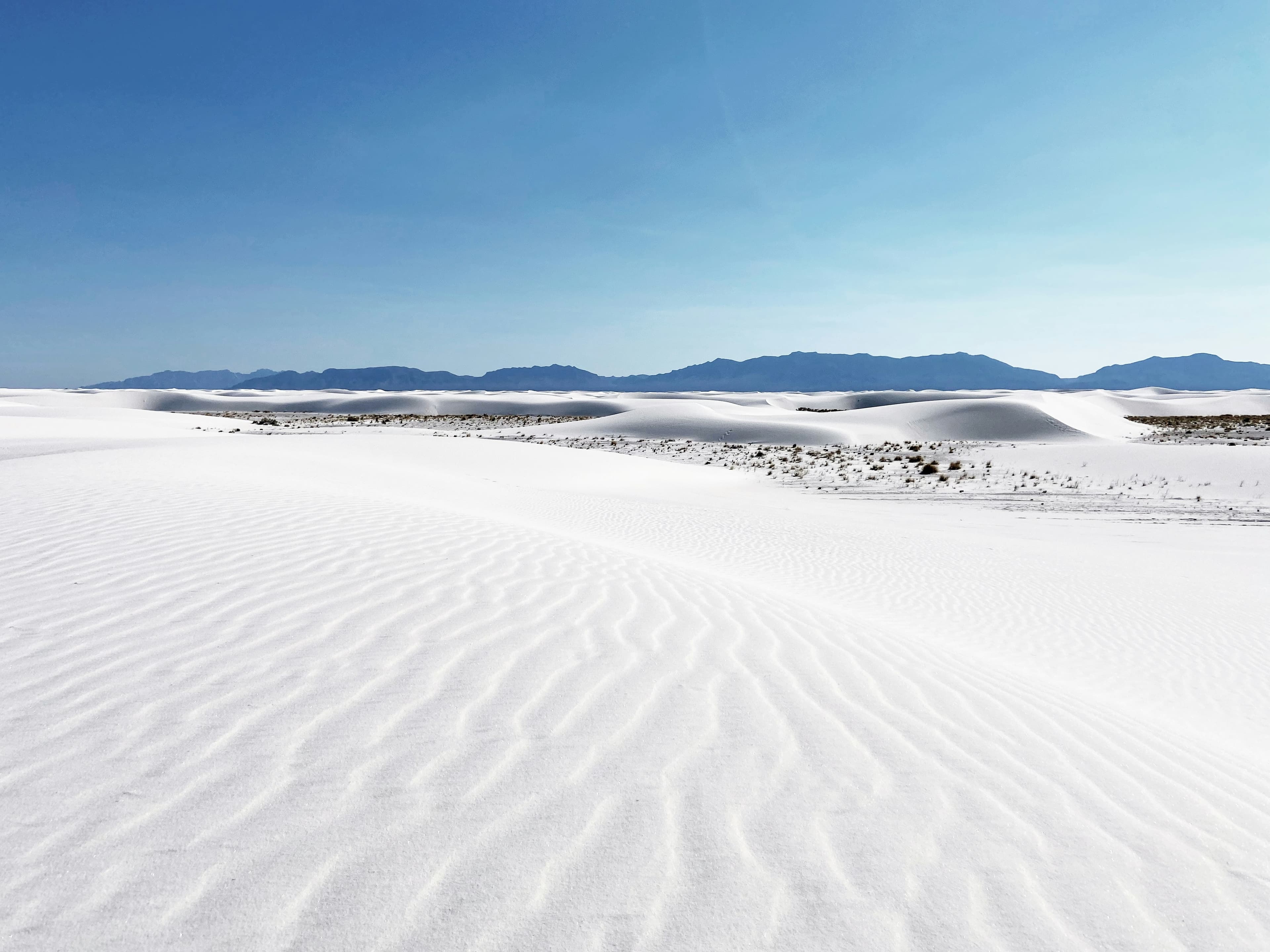
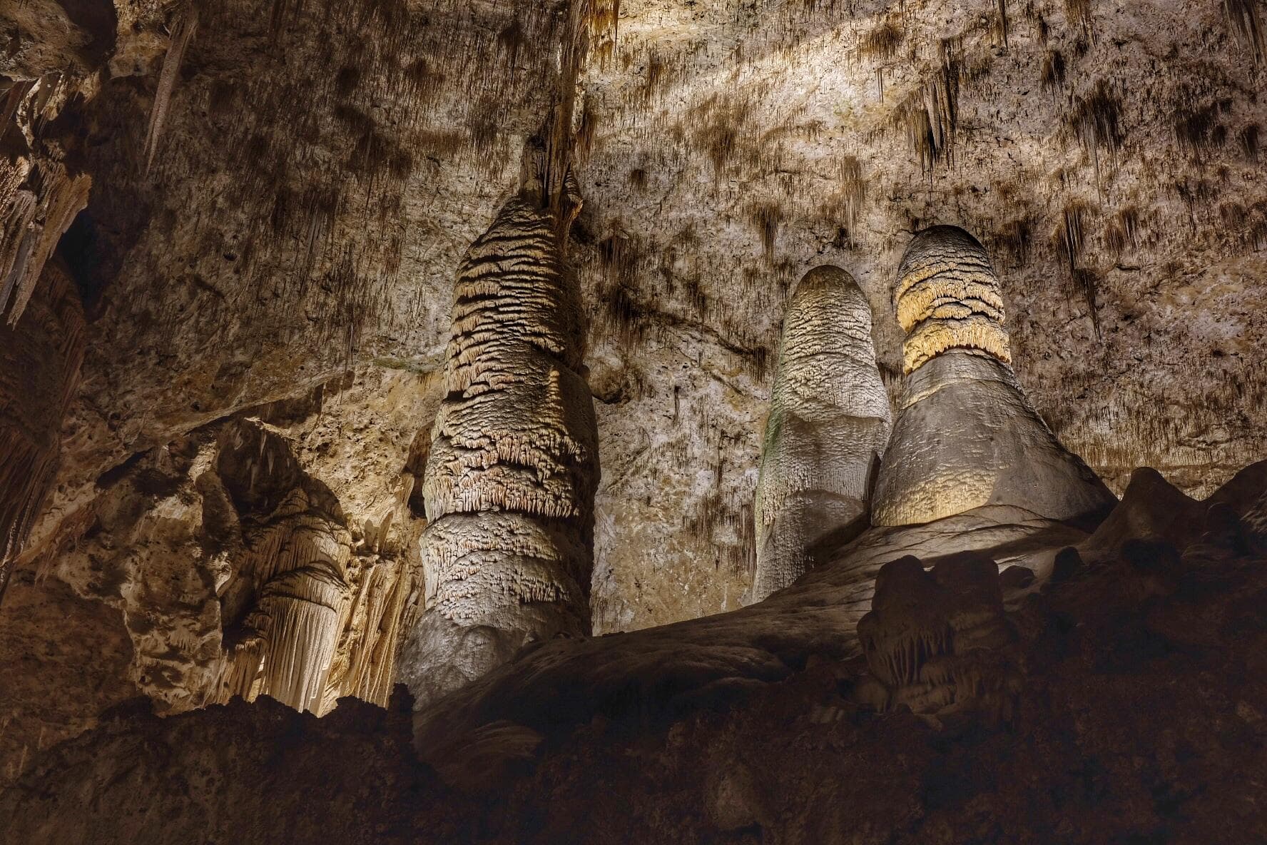
New Mexico camping spreads across high desert, volcanic terrain, and forested mountain ranges that rise unexpectedly from the arid plains. The state holds two national parks: Carlsbad Caverns in the southeast and White Sands in the south-central region. Between them and the Colorado border, the landscape shifts through at least four distinct camping zones. Santa Fe and the Sangre de Cristo Mountains anchor the north with alpine camping above 8,000 feet. The Gila National Forest in the southwest holds New Mexico's largest wilderness area.
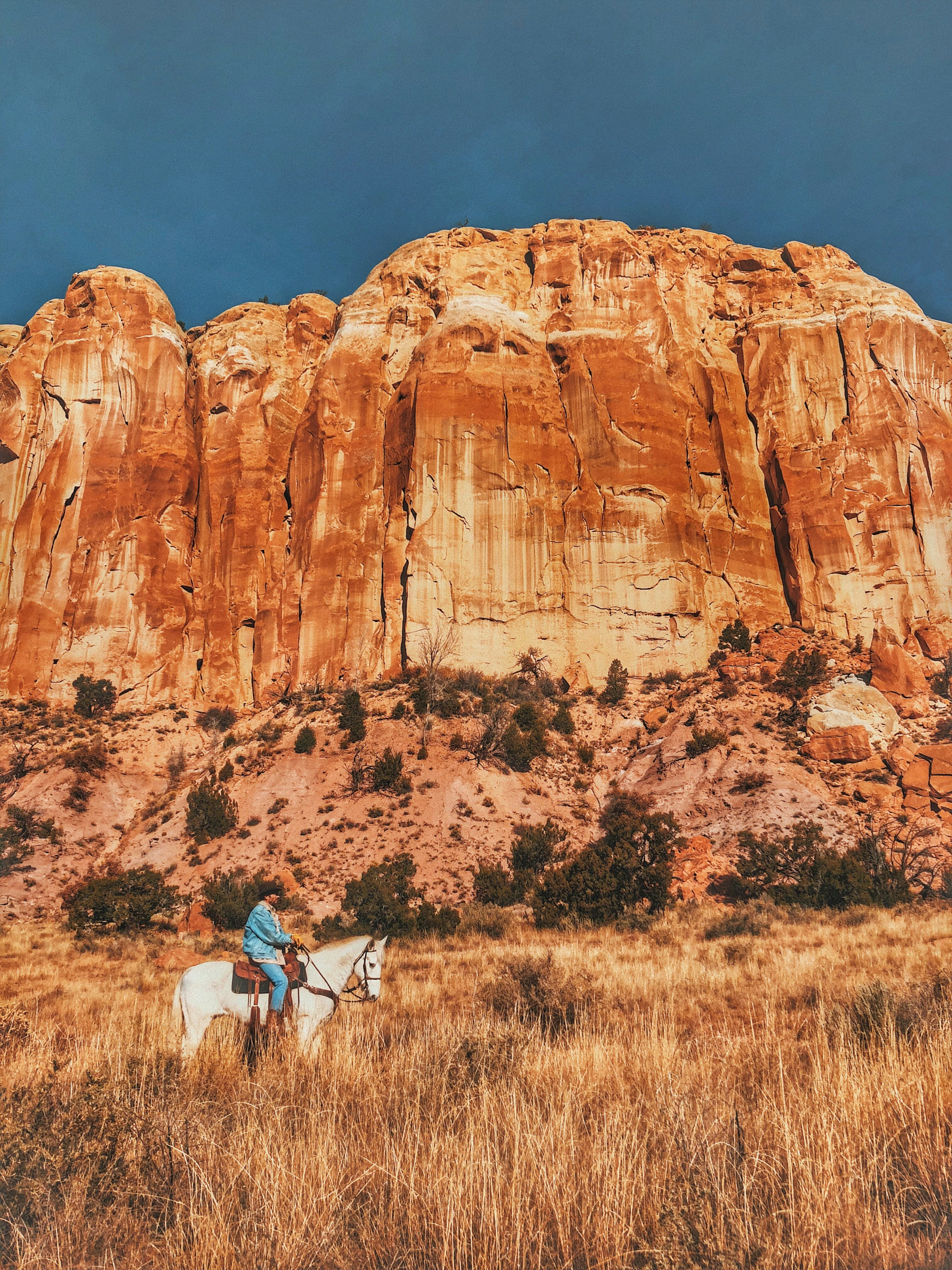
The Rio Grande corridor from Taos south through Albuquerque and Las Cruces provides the population centers, with camping options fanning out from the river valley into the surrounding mountains and desert. Carlsbad in the southeast sits near both the caverns and the Guadalupe Mountains. Silver City in the southwest serves as the entry point to the Gila Wilderness, where the first designated wilderness area in the country was established in 1924.
Mar-May
High 60°F · Low 48°F
Wind season across the plains, but mountain campgrounds begin opening by May. Desert wildflowers bloom in wet years. White Sands and Carlsbad are comfortable before summer heat. Santa Fe and Taos warm into the 60s and 70s.
Jun-Aug
High 78°F · Low 66°F
Mountain campgrounds above 7,000 feet are comfortable while desert areas bake. Monsoon thunderstorms arrive in July, bringing afternoon rain and lightning to mountain areas. The Gila and Santa Fe national forests see peak traffic. Flash flood risk in slot canyons.
Sep-Nov
High 60°F · Low 48°F
Aspen turn gold along the Enchanted Circle near Taos in late September. Monsoon season fades. Desert temperatures return to comfortable levels. One of the best camping windows across all elevations.
Dec-Feb
High 42°F · Low 30°F
Mountain campgrounds close under snow. Southern desert and Carlsbad area stay campable with cool days and cold nights. Santa Fe and Taos draw winter visitors for skiing. January averages 35 degrees statewide but mountain areas run much colder.
| Season | Months | Avg High | Avg Low | Conditions |
|---|---|---|---|---|
| Spring | Mar-May | 60°F | 48°F | Wind season across the plains, but mountain campgrounds begin opening by May. |
| Summer | Jun-Aug | 78°F | 66°F | Mountain campgrounds above 7,000 feet are comfortable while desert areas bake. |
| Fall | Sep-Nov | 60°F | 48°F | Aspen turn gold along the Enchanted Circle near Taos in late September. |
| Winter | Dec-Feb | 42°F | 30°F | Mountain campgrounds close under snow. |
Source: NOAA 30-Year Climate Normals

| Region | Terrain | Key Areas |
|---|---|---|
| Santa Fe and Sangre de Cristo Mountains | Mountain | Santa Fe, Taos, Red River, Angel Fire |
| Gila Country and Southwest | Mountain | Silver City, Deming, Glenwood, Reserve |
| Carlsbad and Southeast | Mountain | Carlsbad, Ruidoso, Cloudcroft, Artesia |
| Rio Grande Valley and Albuquerque | Plains | Albuquerque, Las Cruces, Socorro, Truth or Consequences |
| Northwest and Chaco | Desert | Grants, Jemez Springs, Cuba, Farmington |
Mountain · Santa Fe, Taos, Red River, Angel Fire
The state capital sits at 7,000 feet with the Sangre de Cristo Range rising behind it. The Santa Fe National Forest provides developed and dispersed camping from ponderosa pine into spruce-fir forest. The Pecos Wilderness offers backcountry camping above 10,000 feet. Taos and the Enchanted Circle add alpine camping near Wheeler Peak. Santa Fe Skies RV Park and Rancheros de Santa Fe RV Resort serve the I-25 corridor, while Taos Canyon Stop RV Park covers the northern Sangre de Cristos.
Mountain · Silver City, Deming, Glenwood, Reserve
The Gila National Forest covers 3.3 million acres with the Gila Wilderness at its core. Hot springs along the Middle Fork of the Gila River draw backcountry campers. Silver City serves as the supply town. City of Rocks State Park near Deming offers camping among volcanic rock formations. Lower and warmer than the northern mountains. Manzano's RV Park and Silver City RV Park in Silver City serve the Gila access corridor, while Little Vineyard RV Resort in Deming provides a southern base.
Mountain · Carlsbad, Ruidoso, Cloudcroft, Artesia
Carlsbad Caverns National Park draws visitors underground while camping happens above at the park campground and nearby private facilities. Guadalupe Mountains National Park sits just across the Texas border. The Lincoln National Forest connects the Carlsbad area to Ruidoso and the Sacramento Mountains. Carlsbad RV Park and Campground and Old Cavern RV Park in Carlsbad sit closest to the caverns, while Midtown Mountain Campground in Ruidoso covers the Sacramento Mountains.
Plains · Albuquerque, Las Cruces, Socorro, Truth or Consequences
The Rio Grande corridor from Taos to Las Cruces. Rio Grande del Norte National Monument north of Taos has rim camping above the gorge. The Sandia Mountains east of Albuquerque provide quick mountain access from the city. Bosque del Apache south of Socorro draws birders. Desert terrain at lower elevations. High Desert RV Park in Albuquerque and Sunny Acres RV Park in Las Cruces anchor the Rio Grande corridor's camping infrastructure.
Desert · Grants, Jemez Springs, Cuba, Farmington
Chaco Culture National Historical Park protects ancestral Puebloan ruins with a campground among the canyon. Remote access on dirt roads. El Malpais National Monument near Grants sits on volcanic lava flows. The Jemez Mountains between Albuquerque and Santa Fe hold Bandelier National Monument and hot springs. Grants KOA Journey near Grants serves El Malpais and Chaco access, while YMCA Camp Shaver in Jemez Springs provides a mountain base near Bandelier.

Explore over 119 caves beneath the Chihuahuan Desert, then camp under dark skies where bats spiral at sunset.
View camping guide →
Camp on the world's largest gypsum dunefield, where 275 square miles of white sand glow at sunrise and sunset.
View camping guide →
May through June and September through October offer the best conditions. Spring is dry but windy at lower elevations. Mountain campgrounds open by late May. Fall brings golden aspens and clear skies. Summer monsoons (July through September) bring afternoon storms and flash flood risk.
Many campgrounds sit between 6,000 and 10,000 feet. Santa Fe is at 7,000 feet and mountain camps climb higher. Altitude affects breathing, sleep, and hydration. Drink extra water and allow a day to acclimate before strenuous activity. Lower-elevation desert camping around Carlsbad and Las Cruces sits between 3,000 and 4,000 feet.
Several natural hot springs are accessible from campgrounds. The Middle Fork of the Gila River in the Gila Wilderness has hot springs along the trail. Jemez Springs north of Albuquerque has both developed and primitive options. Truth or Consequences sits on a geothermal zone with commercial and free soaking options.
The first designated wilderness area in the US (1924). Over 500,000 acres of mountain terrain with no roads, no motors, and no cell service. Access requires hiking, often fording the Gila River multiple times. Hot springs, ponderosa forests, and cliff dwellings. Silver City is the nearest town with services.
Among the darkest in the country. Chaco Culture National Historical Park has International Dark Sky Park status. Cosmic Campground in the Gila National Forest is the first International Dark Sky Sanctuary in the US. Even campgrounds near Santa Fe and Taos offer clear skies due to limited light pollution outside the cities.