A complete guide to camping in Arkansas
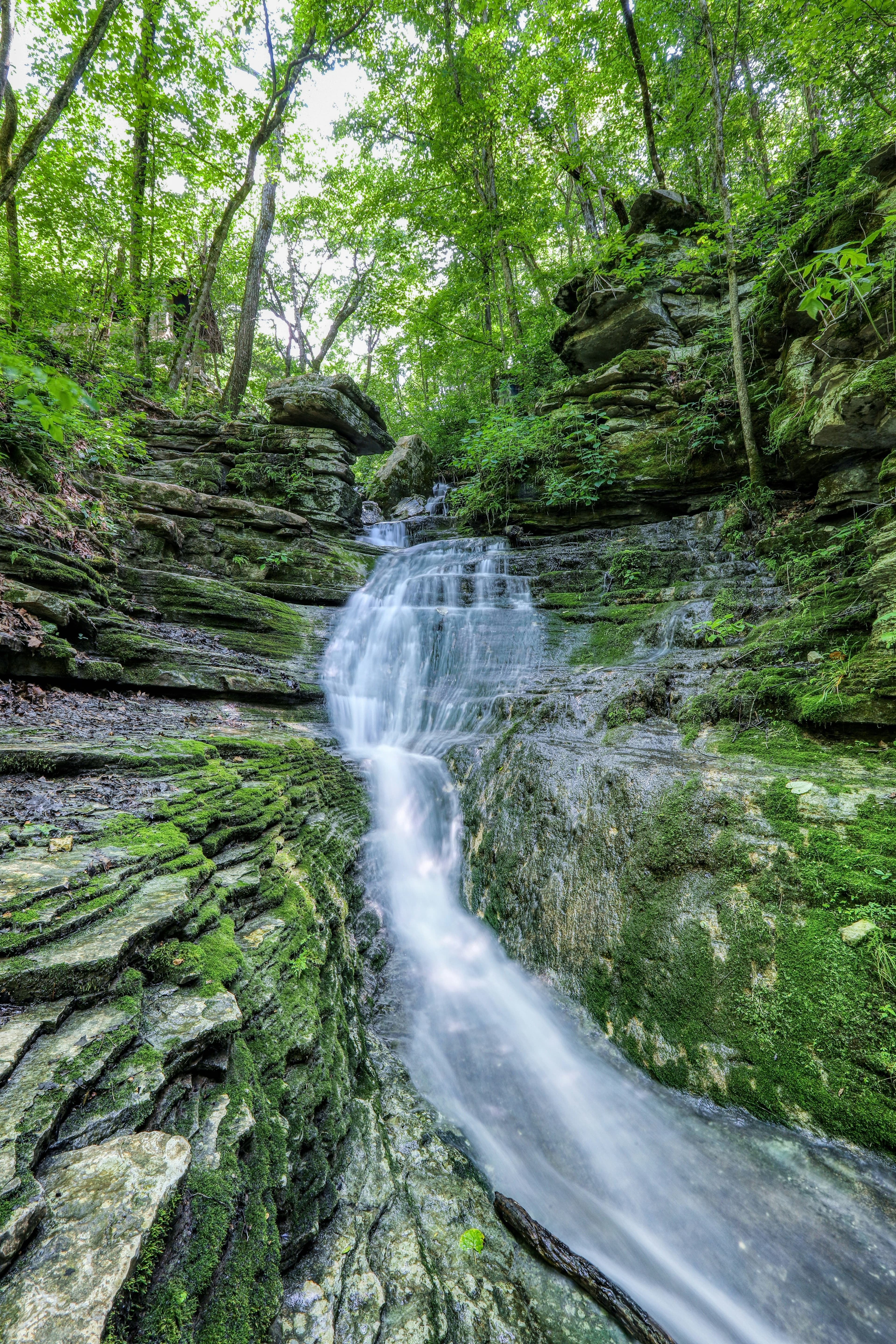
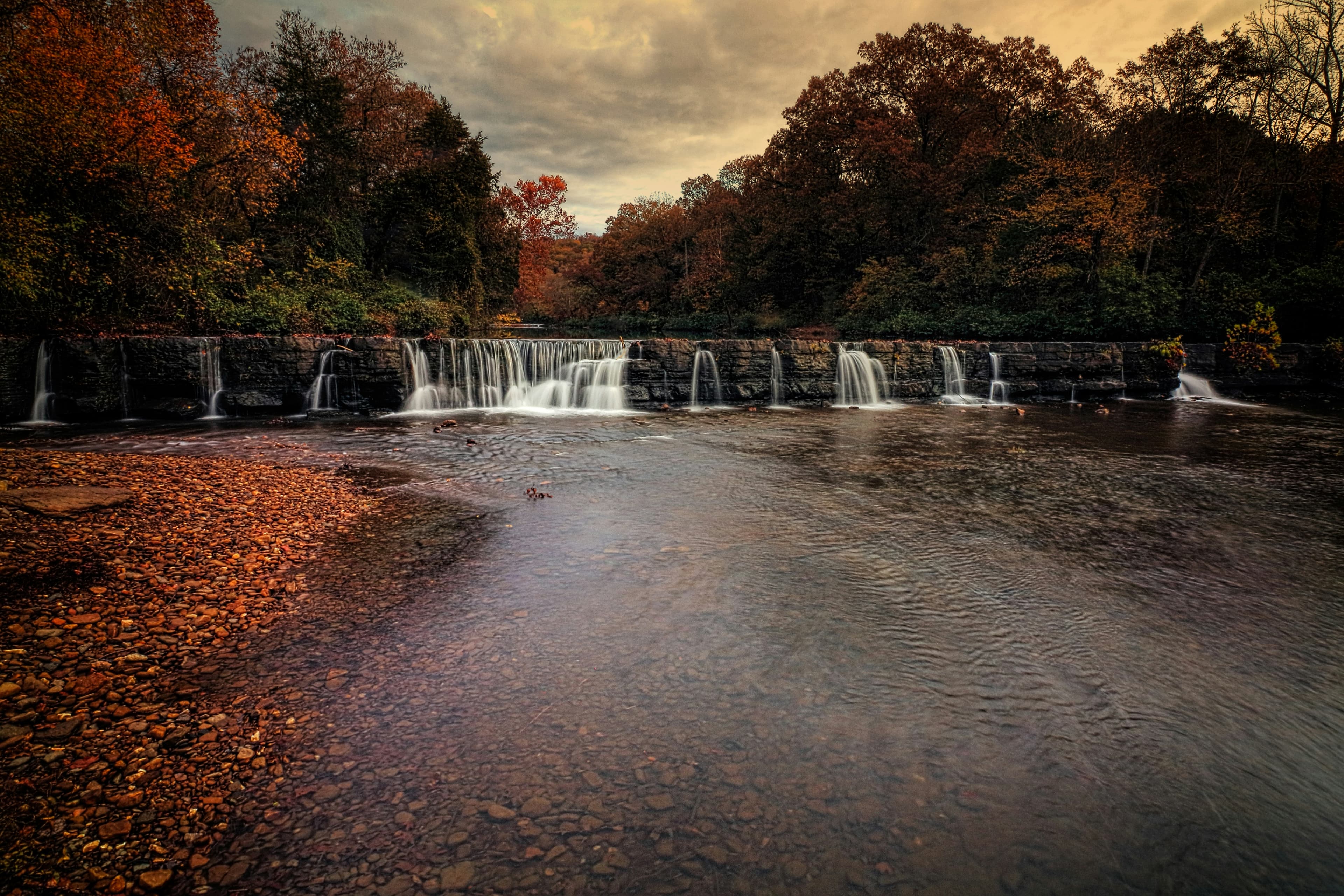
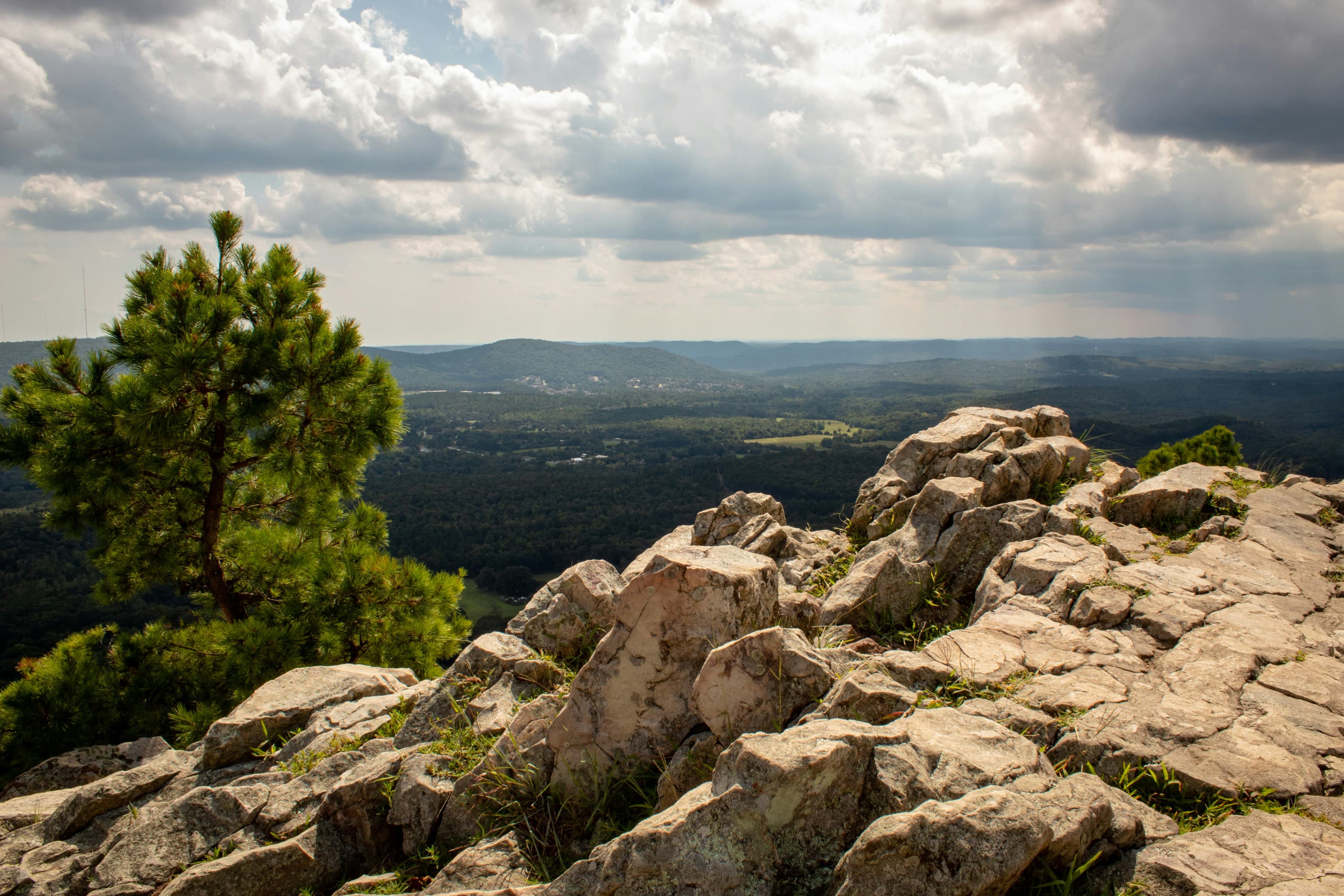
Arkansas camping centers on the Ozark and Ouachita mountain ranges that cover the western and central portions of the state. The Ozark Highlands in the northwest hold the Buffalo National River, the first designated national river in the country, where bluff-top and riverside camping draws canoeists and hikers into deep valleys carved through limestone. Eureka Springs and Mountain View anchor the tourism end of the Ozarks, while Mena and the Ouachita Mountains to the south provide a quieter, ridge-and-valley camping character.
Hot Springs National Park in the central part of the state combines the country's smallest national park with a city built around thermal waters. The surrounding Ouachita National Forest extends into a million acres of pine-and-hardwood hills. Eastern Arkansas flattens into the Mississippi Delta, which holds almost no camping interest but contrasts sharply with the mountainous western half. The state park system operates some of the most developed campgrounds in the region, with many parks including lodges and lake recreation.
Mar-May
High 64°F · Low 52°F
Dogwood and redbuds bloom through the Ozark hollows. The Buffalo River runs high for floating. Temperatures climb into the 60s and 70s. Waterfall flows peak. One of the best camping seasons.
Jun-Aug
High 83°F · Low 71°F
Hot and humid. Mountain campgrounds above 1,500 feet offer partial relief. The Buffalo River drops to wadeable levels by August. Lake campgrounds fill on weekends. July averages 79 degrees. Afternoon thunderstorms common.
Sep-Nov
High 64°F · Low 52°F
Ozark fall color peaks in late October through early November. Cooler and drier than summer. One of the most scenic camping seasons. The Buffalo River and Ozark Highlands Trail draw backpackers.
Dec-Feb
High 45°F · Low 33°F
January averages 37 degrees. Many campgrounds stay open year-round with reduced services. Ice storms hit occasionally. The Ouachitas stay milder than the higher Ozarks. Winter is quiet and uncrowded.
| Season | Months | Avg High | Avg Low | Conditions |
|---|---|---|---|---|
| Spring | Mar-May | 64°F | 52°F | Dogwood and redbuds bloom through the Ozark hollows. |
| Summer | Jun-Aug | 83°F | 71°F | Hot and humid. |
| Fall | Sep-Nov | 64°F | 52°F | Ozark fall color peaks in late October through early November. |
| Winter | Dec-Feb | 45°F | 33°F | January averages 37 degrees. |
Source: NOAA 30-Year Climate Normals

| Region | Terrain | Key Areas |
|---|---|---|
| Buffalo National River and Upper Ozarks | Mountain | Ponca, Jasper, Mountain Home, Harrison |
| Northwest Ozarks | Mountain | Eureka Springs, Bentonville, Fayetteville, Siloam Springs |
| Ouachita Mountains | Forest | Mena, Hot Springs, Mount Ida, Jessieville |
| Ozark Folk Region | Mountain | Mountain View, Heber Springs, Clinton, Shirley |
Mountain · Ponca, Jasper, Mountain Home, Harrison
The Buffalo River flows 135 miles through towering limestone bluffs and hardwood forest. Campgrounds at Steel Creek, Kyle's Landing, and Ozark sit on the river. Ponca and Jasper serve as access towns. Elk reintroduction has brought herds back to the river bottoms. Canoeing, hiking, and swimming in river pools define the activity. Steel Creek Campground and Dogwood Springs Campground near Jasper provide the primary private and public options along the upper Buffalo.
Mountain · Eureka Springs, Bentonville, Fayetteville, Siloam Springs
Eureka Springs, Devil's Den State Park, and the Ozark Highlands Trail anchor the tourism and camping scene. Hobbs State Park on Beaver Lake provides lakefront camping. The terrain rolls through deep hollows and forested ridges. More developed tourism infrastructure than the Buffalo River corridor. Beaver Dam Dive Shop and Resort and Route 62 Motor Resort near Eureka Springs, and Bentonville Bike Camp serve the northwest tourism corridor.
Forest · Mena, Hot Springs, Mount Ida, Jessieville
East-west running ridges of pine and hardwood south of the Arkansas River. Mena sits at the base of Rich Mountain. The Ouachita National Forest covers over a million acres. Lake Ouachita and DeGray Lake offer reservoir camping. Hot Springs National Park sits on the eastern edge. More pine forest and less dramatic bluffs than the Ozarks. Hanson's Camp Wolf Creek and Shadow Mountain RV Park near Mena serve the western Ouachitas, while Catherine's Landing near Hot Springs covers the eastern access.
Mountain · Mountain View, Heber Springs, Clinton, Shirley
Mountain View and the Blanchard Springs area preserve Ozark cultural heritage alongside natural camping. Blanchard Springs Caverns offers cave tours. The Ozark National Forest extends through the region. Smaller crowds than the Buffalo River and Eureka Springs corridors. Ozark RV Park and Cabins and Court Square RV Park in Mountain View, and The Woodlands RV Resort in Heber Springs anchor the folk-region camping.

March through June for the upper sections when water levels support canoeing. The lower Buffalo near Buffalo Point stays floatable longer into summer. By August, the upper river is often too low for boats. Spring flows can be high and fast after rain. Check gauges before launching.
The Ozark and Ouachita National Forests both permit dispersed camping on forest land. No fee or permit required. The Buffalo National River has designated campgrounds (mostly free, first-come) but no dispersed camping outside of designated sites. State parks require reserved campsites.
Among the worst in the country. Lone star ticks are aggressive and abundant from March through October in any wooded or grassy area. Lyme disease, ehrlichiosis, and alpha-gal syndrome (meat allergy triggered by lone star tick bites) are all concerns. Permethrin-treated clothing is the most effective prevention.
Hot Springs National Park is an urban park without campgrounds inside its boundary. Gulpha Gorge Campground sits adjacent to the park. Lake Catherine, Lake Ouachita, and DeGray Lake state parks within 30 minutes provide lake camping. The city's bathhouses and restaurants are accessible from nearby campgrounds.
Elk were reintroduced to the Buffalo National River area in the 1980s and the herd has grown steadily. The Ponca and Boxley Valley areas along the upper Buffalo are the primary viewing zones. Dawn and dusk offer the best sighting opportunities. Elk are wild animals. Maintain at least 100 feet of distance.