
Camping Near Mount Rainier National Park
Washington | Established 1899
About Mount Rainier National Park
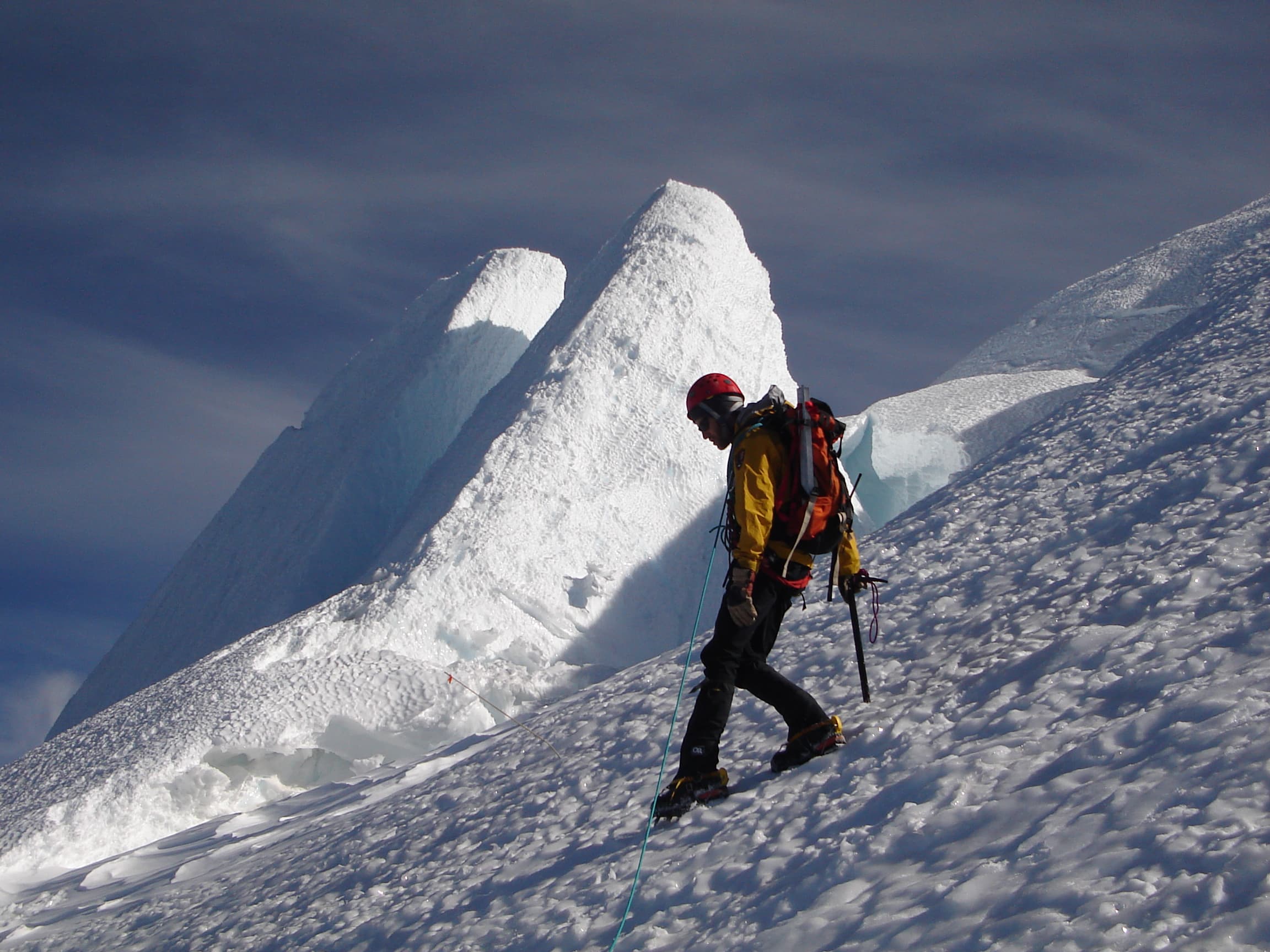
Mount Rainier National Park protects 236,381 acres surrounding the most heavily glaciated peak in the contiguous United States. The volcanic summit rises 14,411 feet above sea level, visible from over 100 miles away on clear days. Twenty-six named glaciers and 36 square miles of permanent snowfields feed five major river systems that carve through old-growth forests and subalpine meadows.
Two drive-in campgrounds operate during peak season: Cougar Rock (173 sites) near the popular Paradise area and White River (88 sites) near the Sunrise area at 4,400 feet. Neither campground has hookups of any kind. Paradise holds the world record for measured snowfall in a single season at 1,122 inches (93.5 feet) during 1971-72, and the area averages 67 feet of snow annually. This extreme snowpack means campgrounds typically open in late June and close by early September.
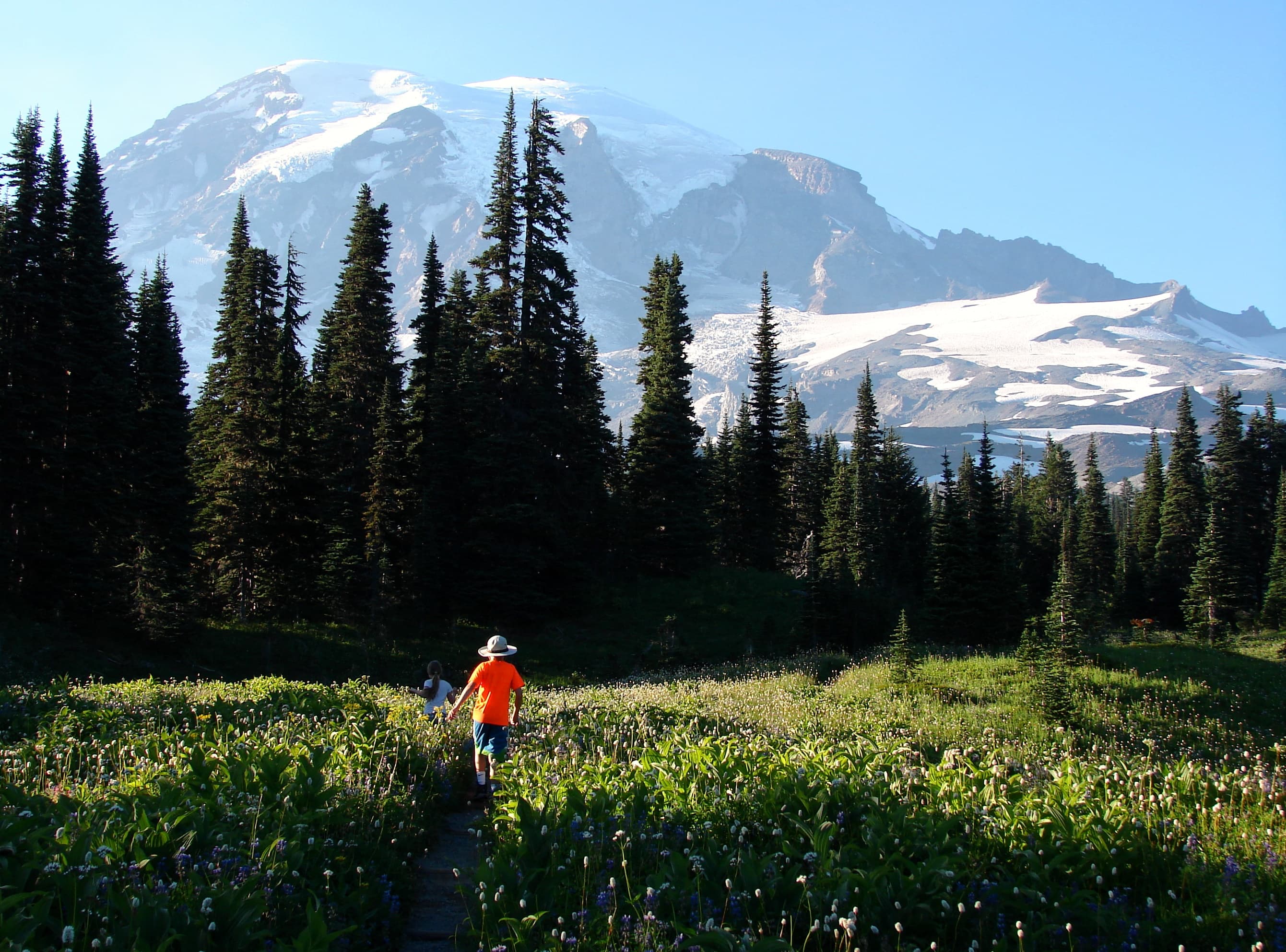
Paradise and Sunrise are the park's two developed alpine areas. Paradise sits at 5,400 feet on the mountain's south side and is famous for wildflower meadows that peak in late July through early August. Sunrise at 6,400 feet on the northeast side is the highest point accessible by road, offering a different perspective of the mountain and access to high-elevation trails along Sourdough Ridge and Burroughs Mountain.
Camping Tips for Mount Rainier
- Reserve Cougar Rock through Recreation.gov six months in advance. White River is first-come, first-served only and fills early on summer weekends. Arrive before noon on Fridays to secure a site.
- No campground has electric, water, or sewer hookups. Cougar Rock accommodates RVs up to 35 feet (motorhomes) or 27 feet (trailers). White River limits are 27 feet for motorhomes and 18 feet for trailers.
- Night temperatures drop into the 40s even in July and August. Bring sleeping bags rated to at least 20 degrees and warm layers. Freezing temperatures are possible any month of the year at elevation.
- Visit Paradise from late July through early August for peak wildflower season. Lupine, paintbrush, and avalanche lilies blanket the subalpine meadows in a wildflower display that draws visitors from across the country.
- Mount Rainier is an active stratovolcano with lahar (volcanic mudflow) risk. Campgrounds post evacuation routes. If you feel sustained ground shaking or hear a roaring sound from a river valley, move to high ground immediately.
RV Parks & Campgrounds Near Mount Rainier National Park

81.Cle Elum River Campground
The Cle Elum River Campground is located within the Okanogan-Wenatchee National Forest. The campground offers a range of recreation opportunities, including hiking, biking, and...
Show more
82.Icewater Creek Campground
The Okanogan-Wenatchee National Forest offers a wide range of recreation opportunities, including over 6,000 miles of trails, 177 campgrounds, and eight Wilderness areas. The...
Show more
83.Clover Flats Campground
Unfortunately, there is no description of the park on the provided website content.
Show more
84.Kaner Flat Campground
Kaner Flat Campground, located in the Little Naches Drainage, is a 49 unit campground that has 25 reservable sites between Memorial Day weekend and Labor Day weekend. After...
Show more
85.Harvest Gate
Unfortunately, the provided website content does not contain any information about the Harvest Gate park, as it appears to be a generic website template with no specific content...
Show more86.Washington State Fair RV Park
The Washington State Fair Event Center is a venue that hosts various events throughout the year, including concerts, fairs, and more. The center offers RV camping options for...
Show more
87.Owhi Campground
The Okanogan-Wenatchee National Forest offers a wide range of outdoor activities and recreation opportunities. With over 6,000 miles of trails, 177 campgrounds, and eight...
Show more
88.East Kachess Group Site
The Okanogan-Wenatchee National Forest offers a wide range of recreational activities, including hiking, biking, climbing, and fishing, with over 6,000 miles of trails and 177...
Show more
89.Sahara Creek DNR Horse Camp
The website does not provide a description of the Sahara Creek DNR Horse Camp. However, it does mention that the camp is located in the Elbe Hills and Tahoma State Forests, which...
Show more90.Takhlakh Lake Campground
The Gifford Pinchot National Forest offers a wide range of recreation opportunities, including hiking, biking, climbing, fishing, hunting, and snow sports. The forest has many...
Show moreShowing 81–90 of 268 campgrounds within 50 miles
Frequently Asked Questions
What campgrounds are inside Mount Rainier National Park?
Mount Rainier has two main drive-in campgrounds: Cougar Rock (173 sites, $20/night, reservable) and White River (88 sites, $20/night, first-come first-served). Mowich Lake offers 13 free walk-in tent sites. No campground has electric, water, or sewer hookups. Campgrounds typically operate from late June through early September.
Cougar Rock is the most popular campground, located near Longmire and the road to Paradise. It accepts RVs up to 35 feet (motorhomes) or 27 feet (trailers). White River sits near the Sunrise area at higher elevation and is best for accessing Sunrise and high-country trails. Ohanapecosh campground (188 sites) on the park's southeast side is closed for major rehabilitation and may not reopen for the current season.
When is wildflower season at Mount Rainier?
Peak wildflower bloom occurs from late July through the first week of August in the subalpine meadows at Paradise (5,400 feet). Lupine, paintbrush, avalanche lilies, and dozens of other species create a wildflower display that draws photographers and hikers from across the country.
The Skyline Trail loop (5 miles) at Paradise offers the best wildflower hiking. Sunrise meadows bloom slightly later due to higher elevation. Snow depth and timing vary each year, shifting the bloom window by one to two weeks. The meadows are fragile, so stay on established trails and boardwalks. Ranger-led wildflower walks are offered daily during peak season from the Paradise visitor center.
Can I bring my dog to Mount Rainier?
Dogs on a leash of six feet or shorter are allowed in campgrounds, parking lots, and on paved roads. Dogs are prohibited on all trails, in wilderness areas, and in park buildings. A small section of the Pacific Crest Trail near the eastern park boundary also allows leashed dogs.
The trail restriction means there are essentially no hiking opportunities with dogs inside the park. For trail hiking with your dog, Gifford Pinchot National Forest surrounds the park on multiple sides and allows leashed dogs on most trails. Mount Tahoma Trails Association also maintains dog-friendly trails near the park. Boarding services are available in Enumclaw and Tacoma.
Is Mount Rainier an active volcano?
Mount Rainier is classified as an active stratovolcano and is considered the highest-risk volcano in the Cascades due to its extensive glacier cover and proximity to populated areas. The primary hazard is lahars, fast-moving volcanic mudflows that can travel down river valleys at 30 to 50 miles per hour.
The USGS monitors the mountain continuously with seismographs and other instruments. Lahar evacuation routes are posted at all campgrounds and visitor areas. If you feel sustained ground shaking or hear a roaring sound from a river valley, move immediately to high ground at least 100 feet above the valley floor. The most recent significant eruption was about 1,000 years ago, but smaller events including debris flows remain an ongoing risk.
How much snow does Mount Rainier get?
Paradise holds the world record for measured snowfall in a single season at 1,122 inches (93.5 feet) set during the winter of 1971-72. The area averages about 67 feet of snow annually. Snow typically blankets Paradise from November through June, and snowpack regularly exceeds 15 feet.
The extreme snowfall means most park roads close from November through May or June. Paradise Road is the only road plowed year-round (weather permitting), though chains may be required. Stevens Canyon Road and Sunrise Road typically open in late June or early July. The snow determines campground opening dates, which vary each year. Check the park website or call 360-569-2211 for current road and campground status before your trip.
What are the best hikes at Mount Rainier?
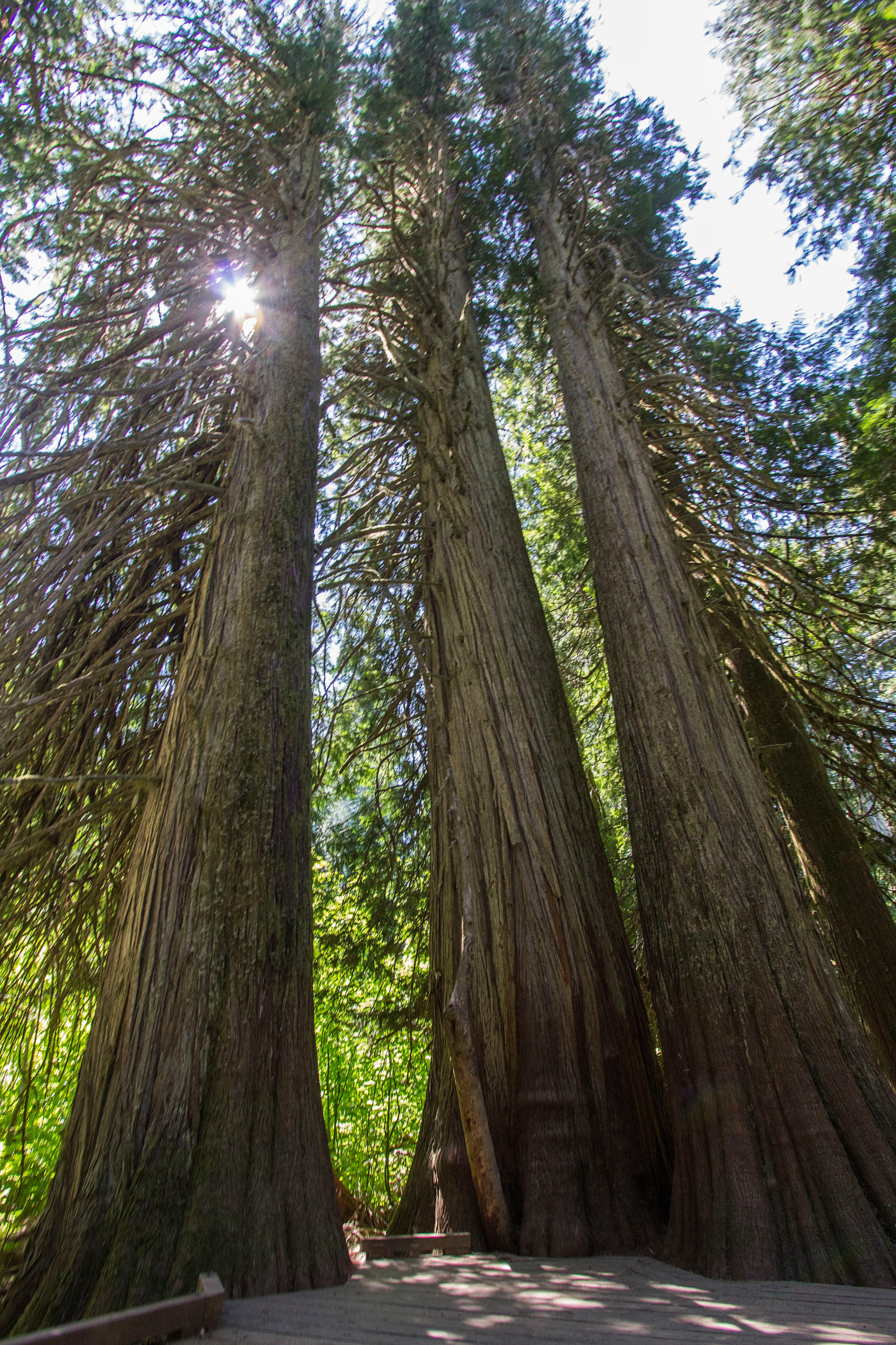
Top hikes include the Skyline Trail loop at Paradise (5 miles, wildflower meadows and Nisqually Glacier views), Burroughs Mountain from Sunrise (7 miles round trip, alpine tundra above treeline), Grove of the Patriarchs (1.5 miles, ancient old-growth forest), and Comet Falls (3.8 miles round trip, 320-foot waterfall).
The 93-mile Wonderland Trail circumnavigates the entire mountain with 22,000 feet of cumulative elevation gain over 10 to 14 days. Backcountry permits are required and distributed through a lottery. For day hikers, the Skyline Trail at Paradise and Burroughs Mountain at Sunrise are the two essential hikes. Both offer close views of glaciers and the mountain's volcanic flanks. Start early as parking at Paradise and Sunrise fills by mid-morning on summer weekends.
What is the Wonderland Trail?
The Wonderland Trail is a 93-mile loop that circles the entire mountain, crossing every major river drainage and ridge in the park. It gains approximately 22,000 feet of cumulative elevation and takes most backpackers 10 to 14 days to complete. A wilderness permit is required.
Permits are distributed through a lottery system on Recreation.gov, typically opening in March for the summer season. The trail is usually snow-free from mid-July through September. Day hikers can access sections of the Wonderland Trail from multiple trailheads without a permit. Popular day-hike sections include Spray Park, Indian Bar, and Summerland, each offering spectacular views of the mountain from different angles.
When is the best time to visit Mount Rainier?
Late July through early August is the ideal window when wildflowers are at peak bloom, all roads and campgrounds are open, and weather is most reliable with daytime highs in the 60s to 70s. Early September offers fewer crowds with still-pleasant weather before the first heavy rains.
The short summer season at Mount Rainier means the window for camping and high-country hiking is compressed into about 10 weeks. June can still have significant snowpack at higher elevations. By mid-October, snow returns and road closures begin. Winter visits offer snowshoeing and cross-country skiing at Paradise, which is accessible year-round by road (weather permitting). The Henry M. Jackson Visitor Center at Paradise is open weekends in winter.
Quick Facts
- Entrance Fee
- $30/vehicle (7 days)
- Best Time to Visit
- July – mid-September
- Nearest Town
- Ashford, WA, Packwood, WA, Enumclaw, WA
- Elevation
- 1,600 – 14,411 ft
- Park Size
- 236,381 acres
- Annual Visitors
- ~2.0 million