Camping Near Lassen Volcanic National Park
California | Established 1916
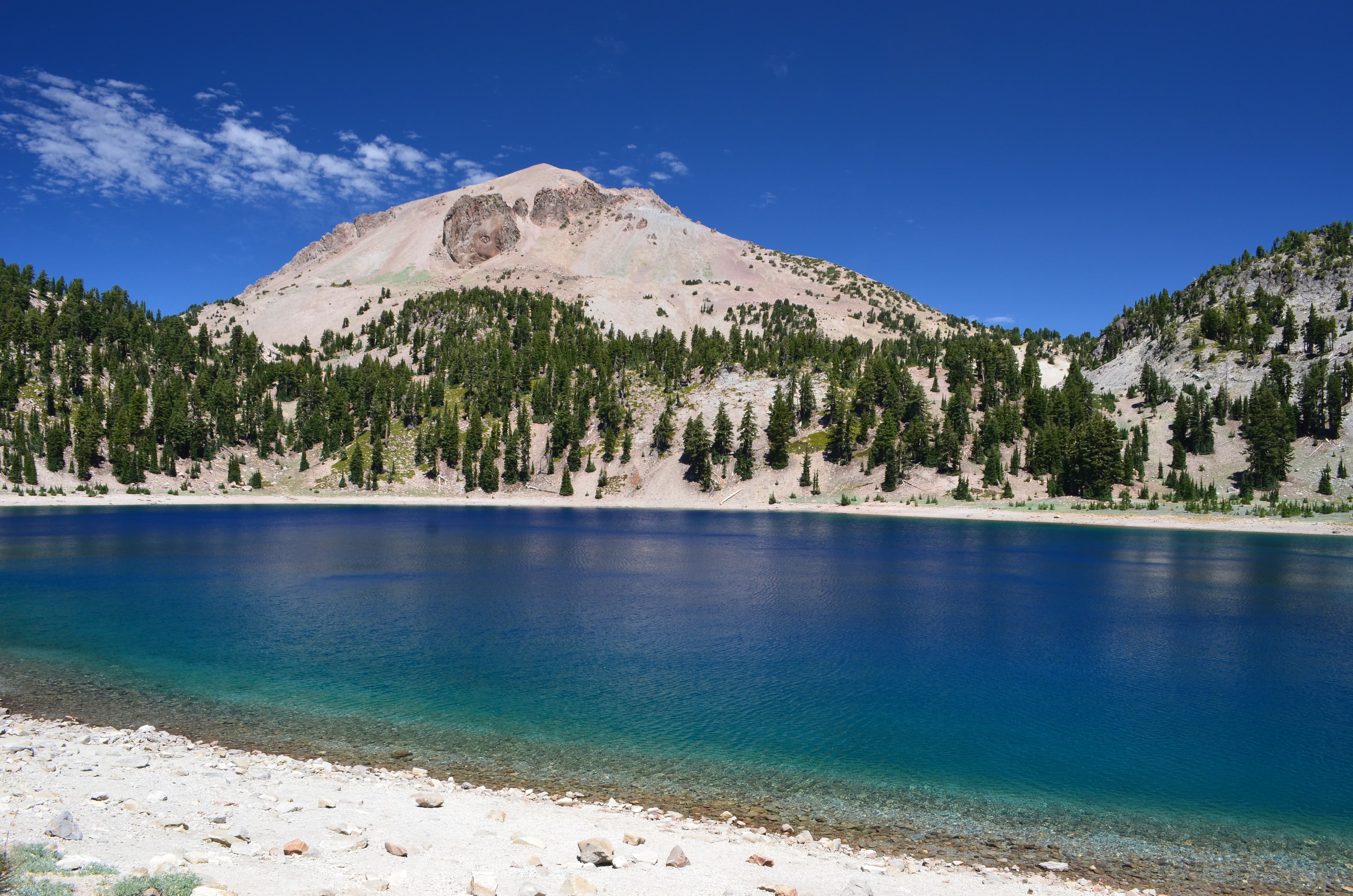
About Lassen Volcanic National Park
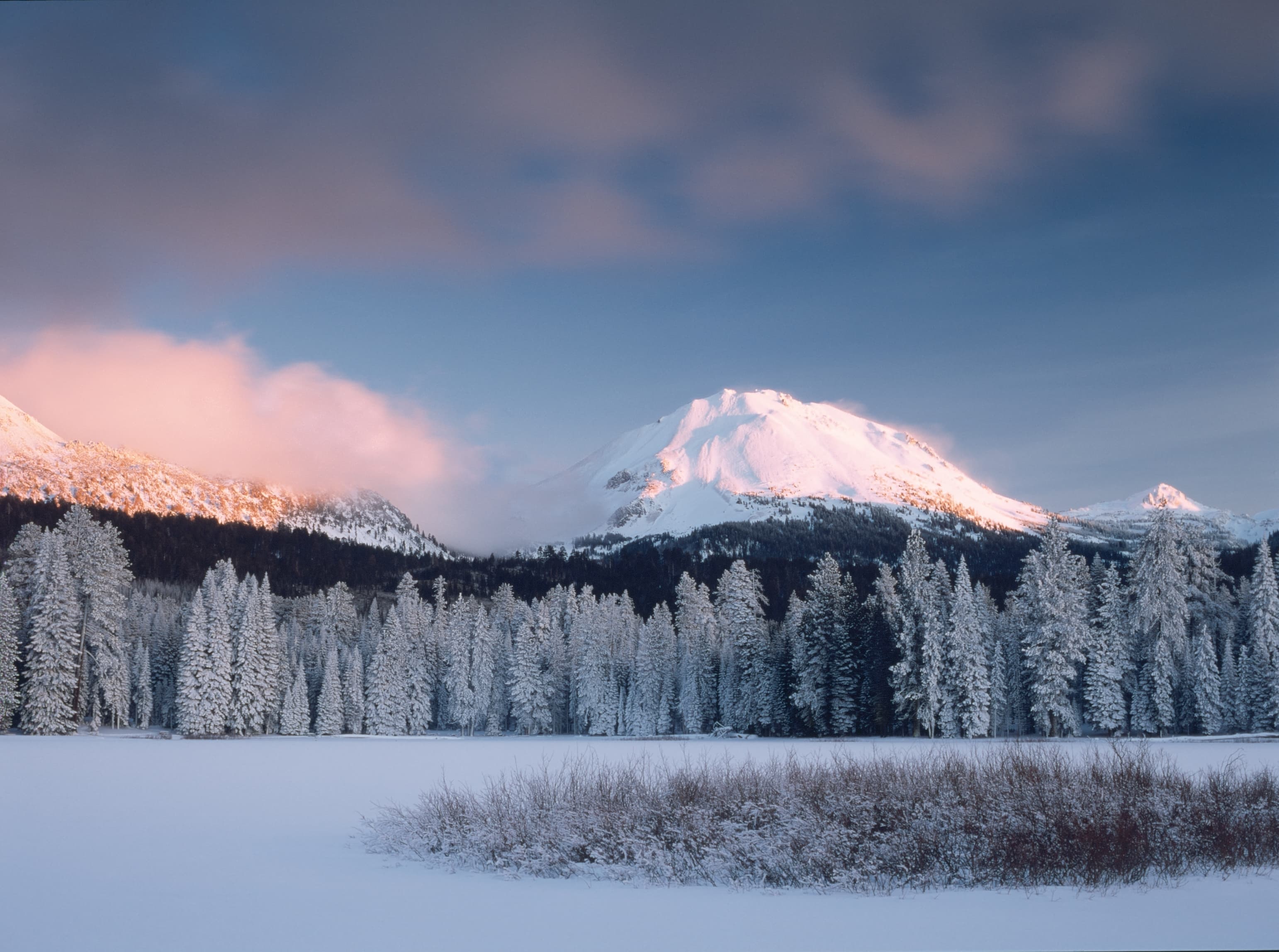
Lassen Volcanic National Park protects 106,372 acres of volcanic terrain in northeastern California, featuring the only place on Earth where all four volcano types coexist: shield volcanoes, composite volcanoes, plug domes, and cinder cones. Lassen Peak, the world's largest plug dome volcano, last erupted from 1914 to 1917. Active hydrothermal areas including Bumpass Hell and Sulphur Works showcase boiling mudpots, steaming fumaroles, and acidic hot springs powered by magma near the surface.
The park operates seven campgrounds with Manzanita Lake (179 sites, $26/night) as the most developed, offering paved roads, flush toilets, showers, and a camp store near the northwest entrance. Summit Lake North and South provide alpine camping at 6,700 feet. Butte Lake (101 sites) in the remote northeast corner offers solitude and dark skies. All campgrounds require recreation.gov reservations. The main park highway typically closes November through June under 400 to 500 inches of annual snowfall, making July through September the primary camping season.
Camping Tips for Lassen Volcanic
- Reserve campgrounds on recreation.gov as soon as dates become available. Manzanita Lake and Summit Lake fill quickly for July and August. Butte Lake in the remote northeast offers easier availability and a no-generator policy for quiet camping.
- The main park highway closes November through June due to heavy snow. Check current road conditions before visiting. Full park access is most reliable from early July through mid-October depending on snowfall.
- Stay on boardwalks at all hydrothermal areas. Ground near hot springs is brittle and conceals scalding acidic water that can cause severe burns on contact. Bumpass Hell opens mid-July after snow melts from the trail.
- Bring layers for high-elevation camping. Manzanita Lake sits at 5,900 feet and Summit Lake at 6,700 feet. Summer days warm to 75 to 80°F but nights drop near freezing even in July and August.
- Rent bear canisters at Loomis Museum or Kohm Yah-mah-nee Visitor Center for backcountry trips. Bear-resistant food storage is required in the backcountry. Never leave packs unattended on trails.
RV Parks & Campgrounds Near Lassen Volcanic National Park

131.Jones Valley Inlet Shoreline Campground
Located in the Shasta-Trinity National Forest, Jones Valley Inlet Shoreline Campground offers a serene setting for outdoor enthusiasts. The campground is open from May 15 to...
Show more
132.Redbridge Campground
Redbridge Campground is located in the Plumas National Forest, offering opportunities for recreation and outdoor activities. The campground is situated in a scenic area, and...
Show more
133.Long Point Campground
Long Point Campground is one of three in the Antelope Lake Recreation Area. It is situated on the lake's southwestern side, providing clear water views at nearly every location...
Show more
134.Eagle Ridge RV Park
Eagle Ridge RV Park is a well-regarded RV park located in Graeagle, California, offering a convenient base for exploring the scenic Sierra Nevada region. With a solid 4.3-star...
Show more
135.Ash Creek Campground
Framed by distinctive geology and views of a timeless landscape, the Modoc National Forest is a place where solitude and recreation come together connecting people to the land and...
Show more
136.Ponderosa Flat Campground
Ponderosa Flat Campground is located along the shore of Butt Valley Reservoir in Plumas County, California. The campground offers 63 fee sites, welcoming both RVs and tents with a...
Show more137.Silver Bowl Campground
Recreation is one of the premier opportunities for visitors to the Lassen National Forest. So go explore, camp, hike, kayak, fish, or just sit beneath the towering pines on a...
Show more138.Camp Discovery Group Campground
Camp in densely forested woodlands or open meadows. Discover secluded flats along river banks and enjoy panoramic views of the majestic North Coast mountains. A continuing goal of...
Show more139.Pine Point Group Camp
Pine Point Campground is situated along the McCloud Arm of Shasta Lake and offers sites to both tent and RV campers. Visitors to this area can enjoy boating and fishing at the...
Show more
140.Bend Mobile Home & RV Park
Bend Mobile Home & RV Park is a well-established RV park located in Red Bluff, California. With a solid 4.2-star rating based on 30 reviews, the park offers a reliable destination...
Show moreShowing 131–140 of 220 campgrounds within 50 miles
Frequently Asked Questions
When is the park fully accessible?
The main park highway typically reopens in late May or June and closes again in November, depending on snowfall. The park receives 400 to 500 inches of snow annually. Bumpass Hell trail opens mid-July most years. July through September offers the most reliable full-park access with all campgrounds and roads open.
Snow removal crews work through spring but continued storms can delay the highway opening. The northwest entrance (Manzanita Lake area) often opens before the full highway is cleared through to the south. Butte Lake in the northeast is accessed by a separate road that may open on a different schedule. Check the park website for current road conditions before planning your visit. Winter activities including snowshoeing and cross-country skiing are available from the southwest entrance.
Which campground is best for families?
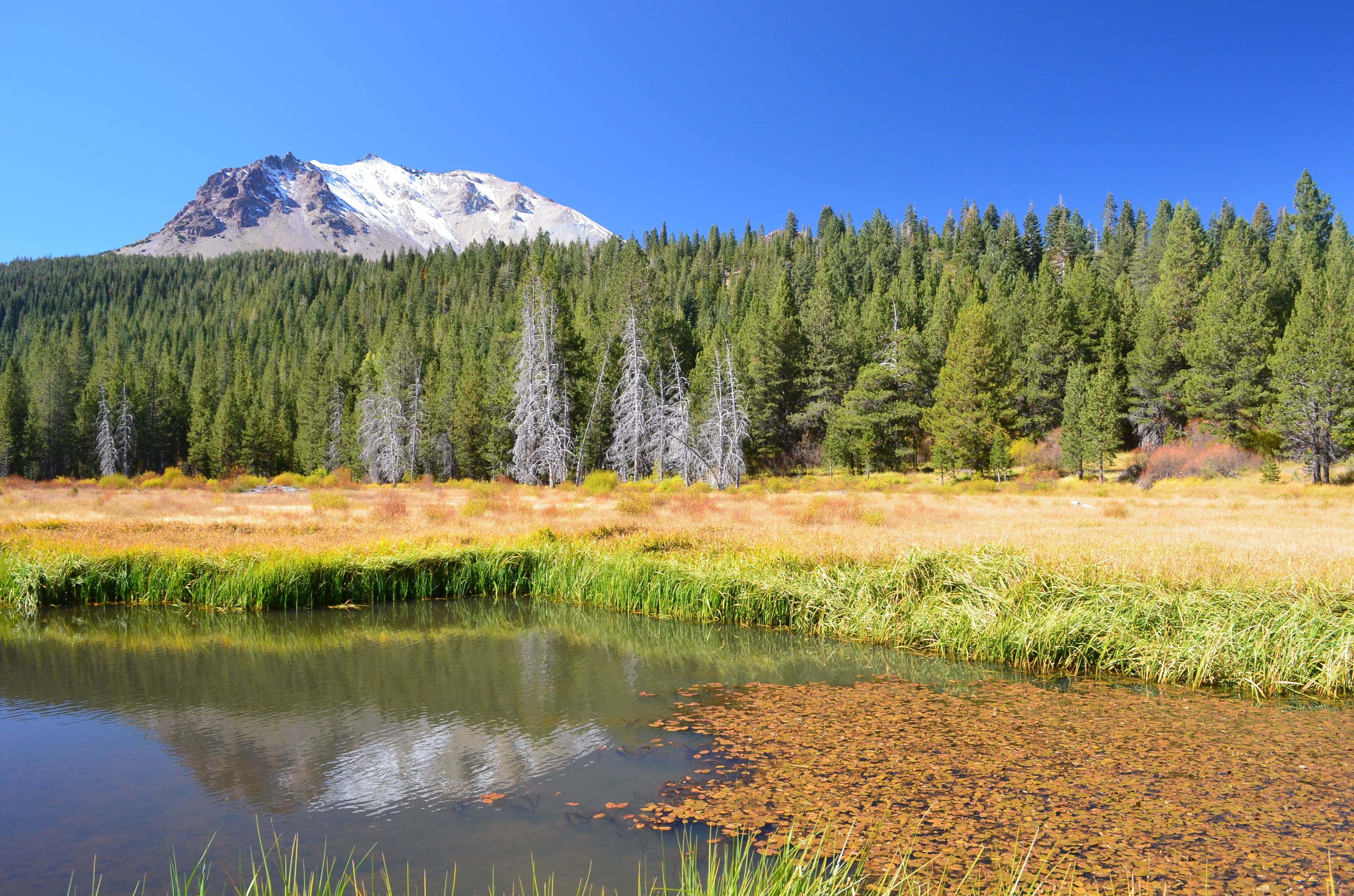
Manzanita Lake Campground is the most family-friendly option with 179 sites, paved roads, flush toilets, hot showers, and a general store within walking distance. The scenic lake offers fishing, swimming, and easy shoreline walks with views of Lassen Peak reflected in the water. Several short, accessible trails leave from the campground area.
Manzanita Lake sits at 5,900 feet in a Jeffrey and ponderosa pine forest with bear-proof lockers at every site. Sites accommodate both tents and RVs. The camp store sells ice, firewood, snacks, and basic supplies. Evening ranger programs run at the amphitheater during summer. The nearby Loomis Museum has volcano exhibits. Summit Lake is a good second choice for families comfortable with fewer amenities and cooler temperatures at 6,700 feet.
Can I see hydrothermal features without strenuous hiking?
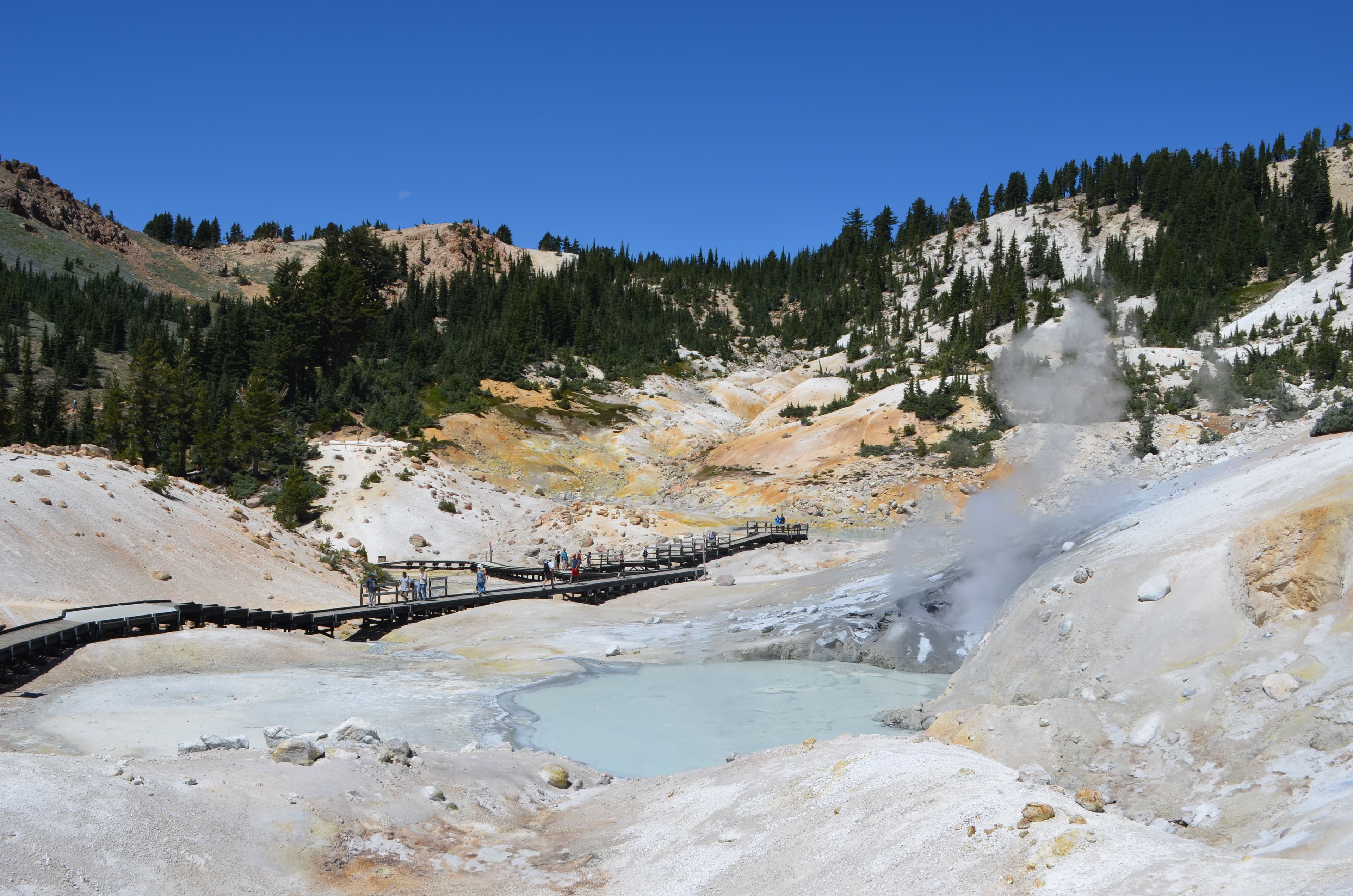
Yes. Sulphur Works is the most accessible geothermal area, located directly alongside the main park highway with a short, paved, wheelchair-accessible boardwalk over steaming vents and mudpots. No hiking is required. Bumpass Hell, the park's largest hydrothermal area, requires a 3-mile roundtrip hike with 300 feet of elevation change.
Sulphur Works offers a quick introduction to the park's geothermal activity without any physical demands. Bumpass Hell is more dramatic with bubbling pools, roaring fumaroles, and colorful mineral deposits spread across a large basin. The Bumpass Hell trail opens mid-July after snow clears. Stay on boardwalks at all times since the thin ground crust conceals scalding acidic water. Temperatures in hydrothermal pools exceed 200°F. Pets are not allowed on any trails.
How difficult is the Lassen Peak summit hike?
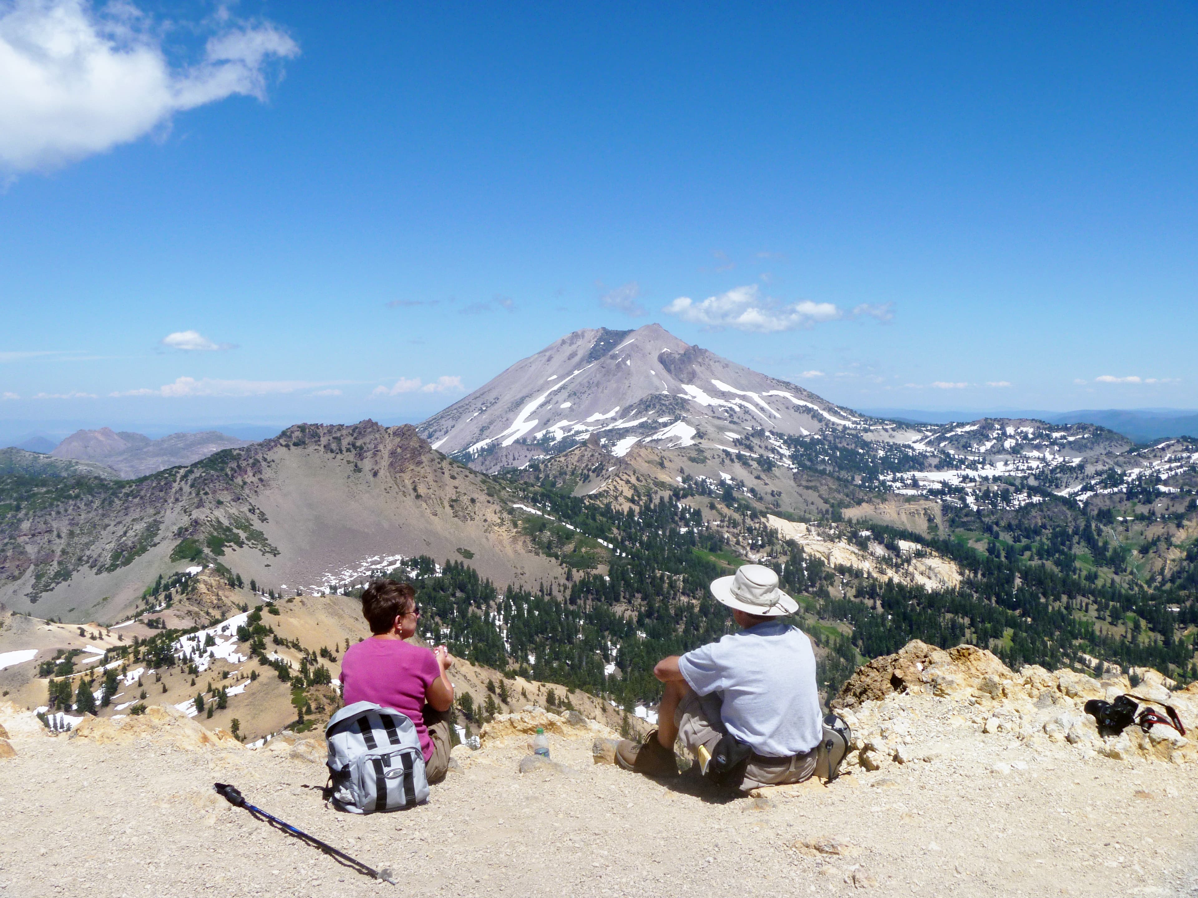
The Lassen Peak Trail climbs 2,000 feet over 2.5 miles (5 miles roundtrip) to the 10,457-foot summit. Most hikers complete it in three to five hours. The trail is moderate to strenuous with loose volcanic scree near the top and full sun exposure. Summit views span the Cascades, Modoc Plateau, and Sierra Nevada.
Start early in the morning to avoid afternoon thunderstorms and heat. Bring at least two liters of water per person and sun protection. The trail opens in June or July depending on snow. High altitude and thin air make the climb more demanding than the distance suggests. The final half mile is the steepest section over loose volcanic rock. On clear days, Mount Shasta is visible 80 miles to the north. Wind at the summit can be fierce, so bring a jacket.
What makes Lassen geologically unique?
Lassen Volcanic is the only park containing all four volcano types in close proximity: shield volcanoes (Prospect Peak), composite volcanoes (remnants of ancient Mount Tehama), plug dome volcanoes (Lassen Peak, the world's largest), and cinder cones (Cinder Cone, which erupted around 1650). This geological diversity is unmatched anywhere else.
The park sits at the southern end of the Cascade Range where it meets the Sierra Nevada and Great Basin. Lassen Peak's 1914 to 1917 eruptions were the most recent volcanic activity in the Cascades before Mount St. Helens in 1980. Active hydrothermal features throughout the park indicate magma remains close to the surface. The Devastated Area along the park highway shows the 1915 mudflow path. Rangers offer geology talks at Manzanita Lake amphitheater during summer.
What wildlife should I watch for at Lassen?
The park supports approximately 30 black bears, American pikas in subalpine rock fields, mule deer, mountain lions, and over 700 flowering plant species. California tortoiseshell butterflies sometimes appear in dramatic migration clouds through the park. Black bears are most active near streams and berry patches in late summer.
Make noise while hiking to avoid surprising bears. If you encounter one, walk away slowly and never run or drop your pack. Bear canisters are required for backcountry food storage and available for rent at the Loomis Museum and Kohm Yah-mah-nee Visitor Center. Pikas live in talus slopes above 8,000 feet and are best spotted at Bumpass Hell and along the Lassen Peak trail. Bald eagles and ospreys fish at Manzanita Lake.
Are pets allowed in the park?
Pets are allowed in developed campgrounds and on paved roads but prohibited on all trails, in the backcountry, and in wilderness areas. This means dogs cannot accompany you on any hike, including Bumpass Hell, Lassen Peak, or Cinder Cone. Pets must remain leashed at all times in permitted areas.
The trail restriction is strictly enforced to protect sensitive volcanic and alpine ecosystems. Plan accordingly if traveling with pets: one person stays with the dog at camp while others hike. The campground areas offer pleasant walking along paved roads. Summer heat at lower elevations can be hard on pets, so bring shade and extra water. No kennel services exist near the park. The nearest boarding options are in Red Bluff or Redding, both over an hour away.
What campground options are available beyond Manzanita Lake?
Summit Lake North and South (46 and 48 sites) sit at 6,700 feet between the two park entrances, offering alpine camping with lake access. Butte Lake (101 sites) in the remote northeast provides excellent dark sky viewing and a no-generator policy. Warner Valley, Juniper Lake, and Southwest Walk-In complete the seven campgrounds.
Summit Lake is popular with hikers accessing the park's central trail network. The lake offers fishing and a cold but refreshing swim. Butte Lake is a 45-minute drive from Manzanita Lake via a separate road and sits near Cinder Cone, a colorful volcanic landmark worth the 4-mile roundtrip hike. Warner Valley and Juniper Lake are accessed by rough dirt roads and offer primitive camping. All seven campgrounds require recreation.gov reservations. Prices range from $22 to $26 per night.
Quick Facts
- Entrance Fee
- $30/vehicle (7 days)
- Best Time to Visit
- July – September
- Nearest Town
- Chester, CA, Red Bluff, CA, Redding, CA
- Elevation
- 5,650 – 10,457 ft
- Park Size
- 106,372 acres
- Annual Visitors
- ~0.6 million